place

Rise, East Riding of Yorkshire

Civil parishes in the East Riding of YorkshireEast Riding of Yorkshire geography stubsHoldernessOpenDomesdayUse British English from June 2015
Villages in the East Riding of Yorkshire
Rise, East Riding of Yorkshire

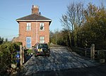
Rise is a village and civil parish in Holderness, the East Riding of Yorkshire, England. It is situated approximately 7 miles (11 km) east of the town of Beverley and 5 miles (8 km) south-west of Hornsea. It lies to the east of the B1243 road. The place-name 'Rise' is first attested in the Domesday Book of 1086, where it appears as Risun in the Holderness Wapentake. This is the plural of the Old English word 'hris', meaning 'brushwood'. According to the 2011 UK census, Rise parish had a population of 105, a reduction on the 2001 UK census figure of 119.Rise was served from 1864 to 1964 by Whitedale railway station on the Hull and Hornsea Railway, until the line was closed following the Beeching Report.

Excerpt from the Wikipedia article Rise, East Riding of Yorkshire (License: CC BY-SA 3.0, Authors, Images).

Rise, East Riding of Yorkshire
Hull Road,

Geographical coordinates (GPS) Address Nearby Places
placeShow on map

Wikipedia: Rise, East Riding of YorkshireContinue reading on Wikipedia

Geographical coordinates (GPS)

Latitude Longitude
N 53.862979 ° E -0.247775 °
placeShow on map

Address

Hull Road

Hull Road
HU11 5BP
England, United Kingdom
mapOpen on Google Maps

Rise, East Riding of Yorkshire
Share experience

Nearby Places

Skirlaugh
Skirlaugh

Skirlaugh is a village and civil parish in the East Riding of Yorkshire, England, in an area known as Holderness. It is situated approximately 7 miles (11 km) north-east of Hull city centre on the A165 road. Originally a farming community, it is now primarily a commuter village for Hull. The name of the village is derived from Old English and originally meant shire clearing. The name is partly due to Old Norse influence, as the village lies in the former Danelaw; it is identical in meaning to Shirley.According to the 2011 UK census, Skirlaugh parish had a population of 1,473, a decrease on the 2001 UK census figure of 1,543. The parish church, St Augustine's Church, was built by Walter de Skirlaw who later became the Bishop of Durham in the late 14th century. It is, according to Pevsner, a "gem of the early-perpendicular" style. This is because subsequent generations left the original structure largely intact. The stonework was re-pointed in the 1980s and 1990s by Edward Brown, a local volunteer. The church is a Local Ecumenical Partnership between the Church of England and the Methodist church. In 1966 the church was designated a Grade I listed building and is now recorded in the National Heritage List for England, maintained by Historic England. Skirlaugh was served from 1864 to 1957 by Skirlaugh railway station on the Hull and Hornsea Railway even though the station was located 1.5 miles (2.4 km) south of the village.Skirlaugh rugby league club, play in the Premier Division of the National Conference League.