place

Morrison Bridge

1887 establishments in OregonBascule bridges in the United StatesBridges completed in 1887Bridges completed in 1905Bridges completed in 1958
Bridges in Portland, OregonBridges over the Willamette RiverBuckman, Portland, OregonDrawbridges on the National Register of Historic PlacesFormer toll bridges in OregonHistoric American Engineering Record in OregonMetal bridges in the United StatesNational Register of Historic Places in Portland, OregonRoad bridges on the National Register of Historic Places in OregonSouthwest Portland, OregonSwing bridges in OregonTom McCall Waterfront Park
Morrison Bridge
Morrison Bridge

The Morrison Bridge is a bascule bridge that spans the Willamette River in Portland, Oregon. Completed in 1958, it is the third bridge at approximately the same site to carry that name. It is one of the most heavily used bridges in Portland. It was added to the National Register of Historic Places in November 2012.

Excerpt from the Wikipedia article Morrison Bridge (License: CC BY-SA 3.0, Authors, Images).

Morrison Bridge
Hauptstraße,

Geographical coordinates (GPS) Address Nearby Places
placeShow on map

Wikipedia: Morrison BridgeContinue reading on Wikipedia

Geographical coordinates (GPS)

Latitude Longitude
N 45.517895 ° E -122.669692 °
placeShow on map

Address

Hauptstraße 12
82269
Bayern, Deutschland
mapOpen on Google Maps

Morrison Bridge
Morrison Bridge
Share experience

Nearby Places

Tom McCall Waterfront Park

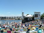
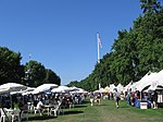
Governor Tom McCall Waterfront Park is a 36.59-acre (148,100 m2) park located in downtown Portland, Oregon, along the Willamette River. After the 1974 removal of Harbor Drive, a major milestone in the freeway removal movement, the park was opened to the public in 1978. The park covers 13 tax lots and is owned by the City of Portland (Portland Parks and Recreation). The park was renamed in 1984 to honor Tom McCall, the Oregon governor who pledged his support for the beautification of the west bank of the Willamette River—harkening back to the City Beautiful plans at the turn of the century which envisioned parks and greenways along the river. The park is bordered by RiverPlace to the south, the Steel Bridge to the north, Naito Parkway to the west, and Willamette River to the east. In October 2012, Waterfront Park was voted one of America's ten greatest public spaces by the American Planning Association.The most common uses for the park are jogging, walking, biking, skateboarding, fountain play, lunching, basketball, fireworks viewing and boat watching. Due to its recreational use, lunch hours (11:00 am to 1:00 pm) are peak-use hours for the waterfront park. In addition to recreational use, the park is also highly used by bike and pedestrian commuters during rush hours (3:00 pm to 5:00 pm) because the park is easily accessible to the downtown Portland workforce and provides a pleasant, off street thoroughfare away from vehicular traffic. It is currently home to the Waterfront Blues Festival, Oregon Brewers Festival, Gay/Lesbian Pride Festival and the Bite of Oregon festival. The park is also the host of many Rose Festival events.