Tees Valley

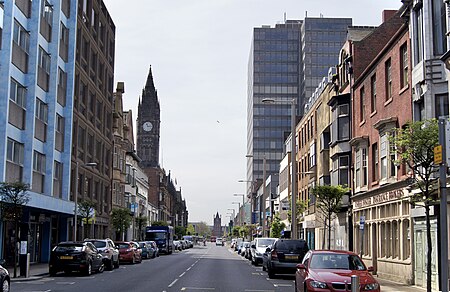
The Tees Valley is a combined authority area in North East England, around the lower River Tees. The area is not a geographical valley; the local term for the valley is Teesdale. The combined authority covers five council areas: Darlington, Hartlepool, Middlesbrough, Redcar and Cleveland and Stockton-on-Tees. The town of Middlesbrough is the largest population centre in the area. The borough of Middlesbrough is the smallest of the five, at only 53.88 square kilometres (20.80 sq mi) and a population of 143,734: the Stockton-on-Tees borough (including multiple towns) is the largest with an area of 204.9 square kilometres (79.1 sq mi) and a population of 197,030, as of 2021 From 1968 until 1974, parts of the area were included in the County Borough of Teesside council area. This was replaced by Cleveland county; it consisted of four districts which became unitary authorities after the county was abolished in 1996. The Darlington district in the Durham county council area became a unitary authority in 1997. A LEP of the same name was established in 2011 and became part of the 2016-created Tees Valley Combined Authority with the local council.
Excerpt from the Wikipedia article Tees Valley (License: CC BY-SA 3.0, Authors, Images).Tees Valley
The Moat,
Geographical coordinates (GPS) Address Nearby Places Show on map
Geographical coordinates (GPS)
| Latitude | Longitude |
|---|---|
| N 54.605 ° | E -1.257 ° |
Address
The Moat
The Moat
TS23 4EG
England, United Kingdom
Open on Google Maps


