Elloughton-cum-Brough
Civil parishes in the East Riding of YorkshireEast Riding of Yorkshire geography stubsUse British English from March 2011

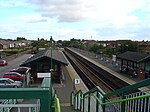
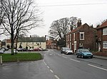
Elloughton-cum-Brough is a civil parish in the East Riding of Yorkshire, England. It is situated 12 miles (19 km) to the west of Hull city centre and covering an area of 975.545 hectares (2,410.62 acres).It comprises the town of Brough and the village of Elloughton. In 2011, the parish council resolved to be called the Elloughton-cum-Brough Town Council.According to the 2011 UK census, Elloughton-cum-Brough parish had a population of 10,075, an increase on the 2001 UK census figure of 7,388.
Excerpt from the Wikipedia article Elloughton-cum-Brough (License: CC BY-SA 3.0, Authors, Images).Elloughton-cum-Brough
Hunter Road,
Geographical coordinates (GPS) Address Nearby Places Show on map
Geographical coordinates (GPS)
| Latitude | Longitude |
|---|---|
| N 53.7335 ° | E -0.5673 ° |
Address
Hunter Road
Hunter Road
HU15 1LG , Elloughton-cum-Brough
England, United Kingdom
Open on Google Maps


