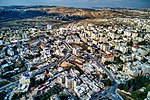
Atarot
1912 establishments in Ottoman SyriaFormer moshavimIsraeli industrial parks in the West BankJewish villages depopulated during the 1948 Arab–Israeli WarNeighbourhoods of Jerusalem ... and 1 more
Populated places established in 1912

Atarot (Hebrew: עטרות) was a moshav in Mandatory Palestine, north of Jerusalem along the highway to Ramallah. It was named after the biblical Atarot mentioned in Joshua 16:2, which is believed to have been situated nearby. The moshav was captured and destroyed by the Jordanian Arab Legion during the 1948 Arab-Israeli War. Atarot Airport, closed since the Second Intifada, and Jerusalem's largest industrial park are now located there.
Excerpt from the Wikipedia article Atarot (License: CC BY-SA 3.0, Authors, Images).Atarot
Bir Nabala Road, Jerusalem Atarot industrial zone
Geographical coordinates (GPS) Address Nearby Places Show on map
Geographical coordinates (GPS)
| Latitude | Longitude |
|---|---|
| N 31.85 ° | E 35.216666666667 ° |
Address
דרך ביר נבאלא
Bir Nabala Road
9773053 Jerusalem, Atarot industrial zone
Jerusalem District, Israel
Open on Google Maps


