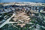
Beit Hanina

Beit Hanina (Arabic: بيت حنينا ,Hebrew: בית חנינא) is an Arab Palestinian neighborhood in East Jerusalem. It is on the road to Ramallah, eight kilometers north of central Jerusalem, at an elevation of 780 meters above sea level. Beit Hanina is bordered by Pisgat Ze'ev and Hizma to the east, Ramot, Ramat Shlomo and Shuafat to the south, Beit Iksa and Nabi Samwil to the west, and Bir Nabala, al-Jib, Kafr Aqab and ar-Ram to the north. Beit Hanina is divided by the Israeli West Bank barrier into Al-Jadida (the new village), which is located within the Israeli Jerusalem municipality and includes the vast majority of the built-up area, and Al-Balad (the old village), which lies outside the municipality. The total area of Beit Hanina is 16.3 sq. kilometers (6.3 sq. miles) or 16,284 dunams, of which 2,775 are built up.In 2007, Beit Hanina had a population of over 27,000, including 26,762 Jerusalem residents in the new village and 1,072 under PNA administration.
Excerpt from the Wikipedia article Beit Hanina (License: CC BY-SA 3.0, Authors, Images).Beit Hanina
Jerusalem Beit Hanina
Geographical coordinates (GPS) Address Nearby Places Show on map
Geographical coordinates (GPS)
| Latitude | Longitude |
|---|---|
| N 31.830555555556 ° | E 35.216111111111 ° |
Address
9726304 Jerusalem, Beit Hanina
Jerusalem District, Israel
Open on Google Maps


