Jerusalem Road 20
All pages needing cleanupRoads in IsraelStreets in East JerusalemStreets in Jerusalem

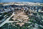
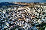
Jerusalem Road 20 is a combination of existing roads and new construction creating a continuous route between Jerusalem's Highway 50 (Begin Boulevard) and Pisgat Ze'ev via Beit Hanina. The number "20" is a designation used by the Jerusalem Municipality. Several segments of the road follow national road 4197. The cost of the project was NIS 180 million and was completed on 5 May 2013.
Excerpt from the Wikipedia article Jerusalem Road 20 (License: CC BY-SA 3.0, Authors, Images).Jerusalem Road 20
Abd AlHamed Shoman, Jerusalem Beit Hanina
Geographical coordinates (GPS) Address Nearby Places Show on map
Geographical coordinates (GPS)
| Latitude | Longitude |
|---|---|
| N 31.829444444444 ° | E 35.226111111111 ° |
Address
עבד אלחמיד שומאן
Abd AlHamed Shoman
9726304 Jerusalem, Beit Hanina
Jerusalem District, Israel
Open on Google Maps


