place

Seacroft

Places in LeedsSeacroft
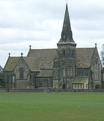
Seacroft from Fearnville 001

Seacroft is an outer-city suburb/township consisting mainly of council estate housing covering an extensive area of east Leeds, West Yorkshire, England. It lies in the LS14 Leeds postcode area, around 4 miles (6.4 km) east of Leeds city centre. It sits in the Killingbeck & Seacroft ward of Leeds City Council and Leeds East parliamentary constituency. The population of the corresponding Leeds City Ward was nearly 18,000 in 2001 and fell to 14,426 in 2011. The name is often used as a catch-all for Seacroft and the neighbouring areas of Whinmoor and Swarcliffe, other large east Leeds council estates which merge into each other. Seacroft includes one of the largest council estates in the country and Yorkshire's second-largest council estate, after Bransholme in Kingston upon Hull. The latter, however, was part of Humberside county from 1974 to 1996. Because of its size, Seacroft has often been referred to as a town. The original vision, envisaged by the council, was that it would be a 'Town within the City Limits', and the Seacroft Civic Centre was often referred to as the 'Seacroft Town Centre'.

Excerpt from the Wikipedia article Seacroft (License: CC BY-SA 3.0, Authors, Images).

Seacroft
Seacroft Crescent, Leeds Seacroft

Geographical coordinates (GPS) Address Nearby Places
placeShow on map

Wikipedia: SeacroftContinue reading on Wikipedia

Geographical coordinates (GPS)

Latitude Longitude
N 53.8222 ° E -1.4599 °
placeShow on map

Address

Seacroft Crescent
LS14 6WS Leeds, Seacroft
England, United Kingdom
mapOpen on Google Maps

Seacroft from Fearnville 001
Share experience

Nearby Places

Swarcliffe
Swarcliffe

Swarcliffe, originally the Swarcliffe Estate, is a district of Leeds, West Yorkshire, England. It is 4.9 miles (8 km) east of Leeds city centre, and within the LS14 and LS15 Leeds postcode area. The district falls within the Cross Gates and Whinmoor ward of the Leeds Metropolitan Council. In the 1950s, the Swarcliffe housing estate was developed by the city council, which built two- and three-bedroomed semidetached council houses, a number of three-storey blocks containing 12 flats or more, and three brick-built nine-storey blocks of flats. Two of the blocks of flats were demolished in the 1990s, and an old people's home was built on the site. In 2007, the remaining block was demolished. The previous year, six of seven 15-storey high-rise blocks of flats, built in 1966 as part of the Whinmoor estate, were demolished. Swarcliffe is served by Swarcliffe Primary School and Nursery, Grimes Dyke Primary School, and St. Gregory's Youth and Adult Centre. Stanks Fire Station provides a service to more than 42,452 people. Swarcliffe has a dwindling number of public houses and shops. Great and Little Swarcliffe Woods lie within the boundaries of the estate. The area is being regenerated by Yorkshire Transformations, a private finance initiative, which is a partnership between Leeds City Council and two private-sector companies: Carillion and the Bank of Scotland. The MP for the Leeds East constituency from 1955 to 1992 was Denis Healey, who represented the Labour Party. He was succeeded by George Mudie MP. In 2009, the population of Swarcliffe and Stanks was 6,751, of which 4,544 were considered to be "hard-pressed", or experiencing financial difficulty.