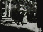
Leeds Rural District
Districts of England created by the Local Government Act 1894History of LeedsRural districts of the West Riding of YorkshireUse British English from August 2012

Leeds was, from 1894 to 1912, a rural district in the administrative county of Yorkshire, West Riding, England. It comprised an area adjacent to, but not including, the City of Leeds. It was alternatively known as the Rural District of Leeds (Roundhay and Seacroft).
Excerpt from the Wikipedia article Leeds Rural District (License: CC BY-SA 3.0, Authors, Images).Leeds Rural District
Wetherby Road, Leeds Monkswood
Geographical coordinates (GPS) Address Nearby Places Show on map
Geographical coordinates (GPS)
| Latitude | Longitude |
|---|---|
| N 53.833 ° | E -1.475 ° |
Address
Wetherby Road
Wetherby Road
LS14 1HP Leeds, Monkswood
England, United Kingdom
Open on Google Maps


