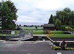
Jubilee River

The Jubilee River is a hydraulic channel in southern England. It is 11.6 km (7.2 mi) long and is on average 45 metres (148 feet) wide. It was constructed in the late 1990s and early 2000s to take overflow from the River Thames and so alleviate flooding to areas in and around the towns of Maidenhead, Windsor, and Eton in the counties of Berkshire and Buckinghamshire. It achieves this by taking water from the left (at this point eastern) bank of the Thames upstream of Boulter's Lock near Maidenhead and returning it via the north bank downstream of Eton. Although successful in its stated aims, residents of villages downstream, such as Wraysbury, claim it has increased flooding in those locations.
Excerpt from the Wikipedia article Jubilee River (License: CC BY-SA 3.0, Authors, Images).Jubilee River
Jubilee River Way,
Geographical coordinates (GPS) Address Nearby Places Show on map
Geographical coordinates (GPS)
| Latitude | Longitude |
|---|---|
| N 51.5047 ° | E -0.6527 ° |
Address
Jubilee River Way
SL4 6QT , Dorney (Beeches Community Board)
England, United Kingdom
Open on Google Maps


