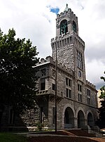
Springfield, Massachusetts

Springfield is the most populous city in and the seat of Hampden County, Massachusetts, United States. Springfield sits on the eastern bank of the Connecticut River near its confluence with three rivers: the western Westfield River, the eastern Chicopee River, and the eastern Mill River. At the 2020 census, the city's population was 155,929, making it the 3rd most populous city in the U.S. state of Massachusetts and the 4th most populous city in New England after Boston, Worcester, and Providence. Metropolitan Springfield, as one of two metropolitan areas in Massachusetts (the other being Greater Boston), had a population of 699,162 in 2020.Springfield was founded in 1636, the first Springfield in the New World. In the late 1700s, during the American Revolution, Springfield was designated by George Washington as the site of the Springfield Armory because of its central location. Subsequently it was the site of Shays' Rebellion. The city would also play a pivotal role in the Civil War, as a stop on the Underground Railroad and home of abolitionist John Brown, widely known for his raid on Harpers Ferry, and for the Armory's manufacture of the famed "Springfield rifles" used ubiquitously by Union troops. Closing during the Lyndon B. Johnson administration, today the national park site features the largest collection of historic American firearms in the world.Today the city is the largest in western New England, and the urban, economic, and media capital of Massachusetts' section of the Connecticut River Valley, colloquially known as the Pioneer Valley. Springfield has several nicknames—"The City of Firsts", due to the many innovations developed there, such as the first American dictionary, the first American gas-powered automobile, and the first machining lathe for interchangeable parts; "The City of Homes", due to its Victorian residential architecture; and "Hoop City", as basketball was invented in Springfield in 1891 by Canadian James Naismith. Hartford, the capital of Connecticut, lies 24 miles (39 km) south of Springfield, on the western bank of the Connecticut River. The Hartford–Springfield region is known as the Knowledge Corridor because it hosts over 160,000 university students and over 32 universities and liberal arts colleges—the second-highest concentration of higher-learning institutions in the United States. The city of Springfield itself is home to Springfield College, Western New England University, American International College, and Springfield Technical Community College, among other higher educational institutions.
Excerpt from the Wikipedia article Springfield, Massachusetts (License: CC BY-SA 3.0, Authors, Images).Springfield, Massachusetts
City Hall Place, Springfield
Geographical coordinates (GPS) Address Nearby Places Show on map
Geographical coordinates (GPS)
| Latitude | Longitude |
|---|---|
| N 42.101388888889 ° | E -72.590277777778 ° |
Address
Springfield City Hall
City Hall Place
01144 Springfield
Massachusetts, United States
Open on Google Maps


