place

Point Loma, San Diego

Geography of San DiegoHistory of San DiegoLandforms of San Diego County, CaliforniaNeighborhoods in San DiegoPeninsulas of California
Point Loma, San DiegoSan Diego BayUse mdy dates from May 2016
Point Loma air photo

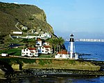
Point Loma (Spanish: Punta de la Loma, meaning "Hill Point"; Kumeyaay: Amat Kunyily, meaning "Black Earth") is a seaside community within the city of San Diego, California. Geographically it is a hilly peninsula that is bordered on the west and south by the Pacific Ocean, the east by the San Diego Bay and Old Town, and the north by the San Diego River. Together with the Silver Strand / Coronado peninsula, the Point Loma peninsula defines San Diego Bay and separates it from the Pacific Ocean. The term "Point Loma" is used to describe both the neighborhood and the peninsula. Point Loma has an estimated population of 47,981 (including Ocean Beach), according to the 2010 Census. The Peninsula Planning Area, which includes most of Point Loma, comprises approximately 4,400 acres (1,800 ha).Point Loma is historically important as the landing place of the first European expedition to come ashore in present-day California. The peninsula has been described as "where California began". Today, Point Loma houses two major military bases, a national cemetery, a national monument, and a university, in addition to residential and commercial areas.

Excerpt from the Wikipedia article Point Loma, San Diego (License: CC BY-SA 3.0, Authors, Images).

Point Loma, San Diego
Cabrillo Memorial Drive, San Diego

Geographical coordinates (GPS) Address Nearby Places
placeShow on map

Wikipedia: Point Loma, San DiegoContinue reading on Wikipedia

Geographical coordinates (GPS)

Latitude Longitude
N 32.67 ° E -117.24194444444 °
placeShow on map

Address

Cabrillo National Monument

Cabrillo Memorial Drive
San Diego
California, United States
mapOpen on Google Maps

Point Loma air photo
Share experience

Nearby Places

Cabrillo National Monument

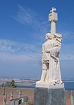
Cabrillo National Monument (Spanish: Monumento nacional Cabrillo) is at the southern tip of the Point Loma Peninsula in San Diego, California, United States. It commemorates the landing of Juan Rodríguez Cabrillo at San Diego Bay on September 28, 1542. This event marked the first time a European expedition had set foot on what later became the West Coast of the United States. The site was designated as California Historical Landmark #56 in 1932. As with all historical units of the National Park Service, Cabrillo was listed on the National Register of Historic Places on October 15, 1966.The annual Cabrillo Festival Open House is held on a Sunday each October. It commemorates Cabrillo with a reenactment of his landing at Ballast Point, in San Diego Bay. Other events are held above at the National Monument and include Kumeyaay, Portuguese, and Mexican singing and dancing, booths with period and regional food, a historical reenactment of a 16th-century encampment, and children's activities. The park offers a view of San Diego's harbor and skyline, as well as Coronado and Naval Air Station North Island. On clear days, a wide expanse of the Pacific Ocean, Tijuana, and Mexico's Coronado Islands are also visible. A visitor center screens a film about Cabrillo's voyage and has exhibits about the expedition. The Old Point Loma Lighthouse is the highest point in the park and has been a San Diego icon since 1855. The lighthouse was closed in 1891, and a new one opened at a lower elevation, because fog and low clouds often obscured the light at its location 129 meters (422 feet) above sea level. The old lighthouse is now a museum, and visitors may enter it and view some of the living areas. The area encompassed by the national monument includes various former military installations, such as coastal artillery batteries, built to protect the harbor of San Diego from enemy warships. Many of these installations can be seen while walking around the area. A former army building hosts an exhibit that tells the story of military history at Point Loma. The area near the national monument entrance was used for gliding activities in 1929-1935. Several soaring endurance records were established here by William Hawley Bowlus and others including the first 1-hour flight in a sailplane, and a 15-hour flight in 1930 which surpassed the world record for soaring endurance. Even Charles Lindbergh soared in a Bowlus sailplane along the cliffs of Point Loma in 1930. Markers for these accomplishments can be found near the entrance, and the site is recognized as a National Soaring Landmark by the National Soaring Museum.

Ballast Point Whaling Station

Ballast Point Whaling Station in San Diego, California in San Diego County, is a California Historical Landmark No. 50 listed on December 6, 1935. The Ballast Point Whaling Station was built in 1858 by Captain Miles A. Johnson his cousins, Henry and James A. Johnson and the twin Packard brothers, Alpheus and William, brothers. The Portuguese-American Johnsons, Alpheus and William came to San Diego from Massachusetts in 1856. The Ballast Point Whaling Station was on Ballast Point. The Whaling station processed whales to make whale oil. Whale oil was a very popular as in oil lamps it produced little smoke. Whale oil was also used in miner's headlamps, lighthouses, soaps, and candles, and as machinery lubricant. In 1869 the United States acquired the site for a quarantine station and built a lighthouse and later Fort Rosecrans, named after Major General William Rosecrans. Whaling operations at Ballast Point stopped in 1873. In 1946 the site became a United States Submarine Base. The site today is Naval Base Point Loma founded in 1959. A Ballast Point Whaling Station historic marker is located on the Navy Base. Before Ballast Point Whaling Station the site was the Spanish Fort GuijarrosCalifornia gray whales were hunted for the Ballast Point Whaling Station. Captain Packard and his brother hunted whales for four years off the California Coast. Portuguese, Africans, Irish, Spaniards, Mexicans and Englishmen all hunted whales on the California Coast. There was a second major whaling station at La Playa. Gray whales swam between warm breeding grounds off Mexico and the rich feeding grounds off Alaska and Arctics. Gray whales were hunted on this route. San Diego whaling ended in the 1880s as petroleum oil was now less costly and the whale population has drop vastly. Gray whales, humpback whales, blue whales, and right whales are now a protected species.

Rosecroft (San Diego)

Rosecroft is a historic estate and gardens in the Point Loma neighborhood of San Diego, California. It was built in 1912 by architect Emmor Brooke Weaver for wealthy heiress Marion James Robinson, née Marion James Duncan (1873-1918), and her husband Alfred D. Robinson (1866-1942), a retired medical instrument merchant. Rosecroft is listed on the National Register of Historic Places.The 15,000-square-foot, Italian Renaissance style mansion, located on Silvergate Avenue in the Wooded Area of Point Loma, sits on 2.5 acres and is considered the largest parcel in the area. The property was originally 10 acres of barley fields. The Robinsons bought the property in 1903 after becoming interested in the ideas of Theosophist Katherine Tingley, who was developing a utopian community "Lomaland" in the Point Loma area. They developed the fields into half a city block of gardens, where they cultivated various ornamental plants, particularly begonias. Marion named the property "Rosecroft" in recognition of her Scottish Highland ancestry.Marion and Alfred were co-founders, along with Kate Sessions, of the San Diego Floral Association, and Alfred was the association's first president, as well as the editor of its magazine, California Garden. Alfred, a self-taught horticulturist, began by experimenting with roses and dahlias, but eventually came to focus on begonias. He became "the pre-eminent begonia expert", developing more than 100 new varieties at the Rosecroft estate. Alfred's were judged "the finest begonias to be grown anywhere in the world" by plant explorer and botanist David Fairchild.After his death in 1942, a new owner opened the garden to the public as Rosecroft Begonia Gardens; the gardens were a popular tourist attraction through the 1960s. In the 1970s the property was sold and the garden area subdivided for residential use. Today the home is a private residence, marked by a National Register plaque. Several private residences occupy the former site of the Rosecroft Begonia Gardens; a stone wall along Silvergate Avenue is the only reminder of that attraction. The mansion, Rosecroft, was added to the National Register of Historic Places by the National Park Service on September 22, 2003. It has been the scene of some notable events including Ronald Reagan's announcement of his candidacy to be Governor of California (1966) and the 80th birthday party of Theodor Seuss Geisel ("Dr. Seuss") (1984). Notable guests at the mansion included Jimmy and Rosalynn Carter, who spent the weekend there during a Habitat for Humanity fundraiser, and winemaker Robert Mondavi, who spent so much time there that a suite was named for him.The estate is periodically opened to charity events, garden tours, weddings, film shoots, and other special events. In 2012, the 100th anniversary of the estate and gardens was commemorated by a tour organized by the San Diego Floral Association, which included the debut of a new variety of geranium named for Anna Gunn Marston, wife of George Marston, a contemporary of Robinson. Charity fundraisers that year included a "Great Gatsby" themed event held by the philanthropic organization Makua to benefit the charity Voices for Children.

Wooded Area, San Diego

The Wooded Area is a neighborhood within the community of Point Loma, San Diego, California. It encompasses the hilltop area south of Talbot Street on both sides of Catalina Boulevard; the area west of Catalina is also referred to as the College Area. The Wooded Area borders Naval Base Point Loma to the south, La Playa to the east, Roseville-Fleetridge to the north, and Sunset Cliffs and Point Loma Nazarene University to the west. The boundaries of the neighborhood are not universally agreed upon, with different maps showing different borders.The Wooded Area gains its name from the large number of Eucalyptus, evergreen, and other trees in the neighborhood. The mature vegetation, along with large lot sizes and lack of sidewalks, contribute to a semi-rural feel. The community is almost entirely residential, except for a small retail center at the corner of Catalina and Talbot streets, and Point Loma Nazarene University at the western edge of the community. Home prices in the area are relatively high and the neighborhood includes several striking mansions, including those built by Reuben H. Fleet, Robert O. Peterson, and Alfred and Marion Robinson. When Richard Henry Dana, Jr. visited San Diego in the 1830s, he described this part of Point Loma as "a well-wooded headland," where he and the other sailors gathered firewood and hunted rabbits. But the trees and brush were largely cut down for use in the growing town of San Diego, and by 1900 when Katherine Tingley created her Theosophical community Lomaland on the western side of what is now the Wooded Area, the area was completely devoid of trees and shrubs. One of Tingley's supporters described the barren slopes as "this God-forsaken spot." Tingley and her Lomaland community planted numerous orchards and trees throughout the area, particularly eucalyptus and avocado, and are generally credited with creating the "wooded" feel that the area enjoys today. The Wooded Area was once home to Rosecroft Begonia Gardens, a several-acre begonia garden which was a tourist attraction for several decades. Rosecroft Begonia Gardens closed in the 1960s and was replaced by homes in the 1970s, but a historic stone wall and a street name commemorate the site. The gardens were originally part of the grounds of the 1912 estate "Rosecroft," which still stands and is listed on the National Register of Historic Places.

Naval Information Warfare Systems Command

The Naval Information Warfare Systems Command (NAVWARSYSCOM), based in San Diego, is one of six SYSCOM Echelon II organizations within the United States Navy and is the Navy's technical authority and acquisition command for C4ISR (Command, Control, Communications, Computers, Intelligence, Surveillance and Reconnaissance), business information technology and space systems. Echelon II means that the organization reports to someone who, in turn, reports directly to the Chief of Naval Operations on the military side. From a civilian perspective, NAVWARSYSCOM reports to the Assistant Secretary of the Navy (RDA). The command was formerly known as SPAWAR, or the Space and Naval Warfare Systems Command and was renamed in June 2019 to better align its identity with its mission.NAVWARSYSCOM supports over 150 programs managed by the Program Executive Office (PEO) for Command, Control, Communications, Computers and Intelligence (C4I), as well as the programs of PEO for Enterprise Information Systems (PEO EIS) and PEO Space Systems. These PEOs are located in the greater Washington, D.C. area. The Naval Information Warfare Center (NIWC) Atlantic is located in Charleston, SC, and also includes facilities in Norfolk, VA, New Orleans and Stuttgart, Germany. NIWC Pacific is located in San Diego, and includes facilities in Japan, Guam and Hawaii. Effective February 18, 2019, the names of the systems centers changed to Naval Information Warfare Center Atlantic and Pacific.