High Hunsley
Deserted medieval villages in the East Riding of YorkshireHamlets in the East Riding of YorkshireTransmitter sites in EnglandUse British English from December 2014

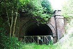
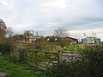
High Hunsley is a small hamlet in the East Riding of Yorkshire, England. It is situated in the Yorkshire Wolds approximately 6 miles (10 km) south-west of Beverley town centre and 2 miles (3 km) north-west of the village of Little Weighton. High Hunsley forms part of the civil parish of Rowley. It is situated on the B1230 road and the Yorkshire Wolds Way passes close to the west. In 1823 Hunsley (then both High and Low), was in the civil parish of Rowley and the Wapentake of Harthill. Occupations at the time included two farmers, a corn factor (trader), a yeoman, and a gentlewoman.
Excerpt from the Wikipedia article High Hunsley (License: CC BY-SA 3.0, Authors, Images).High Hunsley
The Avenue,
Geographical coordinates (GPS) Address Nearby Places Show on map
Geographical coordinates (GPS)
| Latitude | Longitude |
|---|---|
| N 53.804 ° | E -0.557 ° |
Address
The Avenue
The Avenue
HU17 8SZ
England, United Kingdom
Open on Google Maps


