Zuilen
Former municipalities of Utrecht (province)

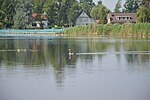
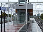
Zuilen is a district in the Northwest section of the Dutch city of Utrecht. Zuilen is bordered by the train line and the river Vecht, the Amsterdam-Rhine Canal, the street Marnixlaan, and the city borders at the north. The neighborhood Elinkwijk, located in Zuilen, contains the protected city view Beschermd Stadsgezicht Zuilen-Elinkwijk. Buildings within this area are not automatically protected monuments, but the city government will monitor and adjust zoning and planning in the area to protect the look of the area.
Excerpt from the Wikipedia article Zuilen (License: CC BY-SA 3.0, Authors, Images).Zuilen
Zuilenselaan, Stichtse Vecht
Geographical coordinates (GPS) Address Nearby Places Show on map
Geographical coordinates (GPS)
| Latitude | Longitude |
|---|---|
| N 52.1272 ° | E 5.0694 ° |
Address
Zuilenselaan 4
3611 AP Stichtse Vecht
Utrecht, Netherlands
Open on Google Maps


