place

James City County, Virginia

1634 establishments in VirginiaJames City County, VirginiaPopulated places established in 1634Use mdy dates from December 2021Virginia counties
JCC and Williamsburg Courthouse

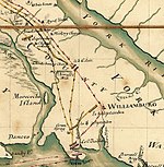
James City County is a county located in the Commonwealth of Virginia. As of the 2020 census, the population was 78,254. Although politically separate from the county, the county seat is the adjacent independent city of Williamsburg.Located on the Virginia Peninsula, James City County is included in the Virginia Beach-Norfolk-Newport News, VA-NC Metropolitan Statistical Area. It is often associated with Williamsburg, an independent city, and Jamestown which is within the county. First settled by the English colonists in 1607 at Jamestown in the Virginia Colony, the county was formally created in 1634 as James City Shire by order of King Charles I. James City County is considered one of only five original shires of Virginia to still be extant today in essentially the same political form. The Jamestown 2007 celebration marked the 400th anniversary of the founding of Jamestown. Tourism is a major part of the region's economy, as is high technology. The College of William and Mary is nearby, as well as NASA, Jefferson Laboratory, and numerous defense contractors, giving the region the highest concentration of scientists and engineers per capita in the nation. James City County is home to the Busch Gardens Williamsburg theme park, the Kingsmill Resort, and the Williamsburg Pottery Factory. The Historic Jamestowne and Jamestown Settlement attractions combine with Colonial Williamsburg, and are linked to Yorktown by the National Park Service's Colonial Parkway.

Excerpt from the Wikipedia article James City County, Virginia (License: CC BY-SA 3.0, Authors, Images).

James City County, Virginia
Highgate Green,

Geographical coordinates (GPS) Address Nearby Places
placeShow on map

Wikipedia: James City County, VirginiaContinue reading on Wikipedia

Geographical coordinates (GPS)

Latitude Longitude
N 37.31 ° E -76.77 °
placeShow on map

Address

Highgate Green 5318
23188
Virginia, United States
mapOpen on Google Maps

JCC and Williamsburg Courthouse
Share experience

Nearby Places

Ewell, Virginia
Ewell, Virginia

Ewell was an unincorporated town in James City County west of Williamsburg, in the U.S. state of Virginia. Ewell was named for Benjamin Stoddert Ewell, who was a U.S. and Confederate army officer, and civil engineer. A local farmer, he is best remembered for his presidency of the College of William and Mary in nearby Williamsburg during turbulent times for the school before and after the American Civil War. Ewell's tireless efforts to restore the historic school and its programs during and after Reconstruction became legendary in Williamsburg and at the College and were ultimately successful, with funding from both the U.S. Congress and the Commonwealth of Virginia. Benjamin Ewell remained in Williamsburg as President Emeritus of the College until his death in 1894. In 1881, the Chesapeake and Ohio Railway (C&O) was extended east from Richmond to a new coal pier at Newport News on the harbor of Hampton Roads. The railroad's new Peninsula Subdivision opened new shipping opportunities for the farmers of the region. In James City County, new railroad stations were established every few miles, at Diascund, Toano, Vaiden's Siding (Norge), Kelton (Lightfoot) and Ewell, Williamsburg, and Grove. In the mid 20th century, the smaller stations along the line were discontinued as trucking assumed most of the shipping business, although Williamsburg remained open for passenger services. The wooden station from Ewell was relocated a short distance away and was in alternate use as of June 2013. The larger station building from Norge has also been preserved, and was relocated to a site adjacent to the Williamsburg Regional Library branch on Croaker Road. Along U.S. Route 60, a portion of the old Richmond-Williamsburg Stage Road, Ewell Hall, the historic plantation house built by Benjamin Ewell eventually became the restored centerpiece of a cemetery, Williamsburg Memorial Park.As the Williamsburg community expanded even beyond the city limits, Ewell lost its individual identity and became part of an area popular with tourists for outlet shopping, hotels, restaurants and attractions. Ewell is no longer a mailing address, and is now considered one of the former counties, cities, and towns of Virginia.

Lightfoot, Virginia
Lightfoot, Virginia

Lightfoot (formerly Kelton) is an unincorporated community which straddles the James City–York county border, west of Williamsburg, in the U.S. state of Virginia. Originally known as Six-Mile Ordinary, Lightfoot is six miles west of the colonial capital on the Richmond Road (U.S. Route 60), which, as well as Centerville and Longhill roads, dates to the pre-Revolutionary War period. Six-Mile Ordinary was located along the old stagecoach road to New Kent County and Richmond. (An ordinary was a colonial-era tavern with food and lodging for travelers and their horses.) Nearby, by tradition, the land at War Hill (or, as it came to be called, Warhill) is named for an American Revolutionary War battle that took place there on June 26, 1781, between British troops under Lord Cornwallis and allied forces under the Marquis de Lafayette. Nearly 150 men were killed or wounded in the battle, which occurred during the campaign that led to the victory at Yorktown, establishing independence for Virginia and the United States. In 1881, the Chesapeake and Ohio Railway was built through the area, and a local station named Kelton was established in what is now the Lightfoot area. The source of the station's name is not clear. In 1882, when a post office was established, the first postmaster suggested the name of Philip Lightfoot, who had been a prominent lawyer and merchant prior to 1748. However, it may also have been named for Lightfoot Taylor, who ran a stage stop there in the 1880s. In modern times, Lightfoot is probably best known as home to the expansive Williamsburg Pottery Factory. At one time, the entrance to the Lightfoot community had a sign that read "Welcome to Lightfoot, Home of the Williamsburg Pottery Factory." Lightfoot also has a strip of outlet and specialty shops, hotels, motels, and restaurants, including the Great Wolf Lodge family resort, and a small but popular amusement park called Go-Karts Plus. In 2006, the Sentara Health System opened the new Sentara Williamsburg Regional Medical Center off Mooretown Road. Nearby are Interstate 64, U.S. Route 60, and State Route 199, a semi-circumferential highway around Williamsburg that has its western terminus at Lightfoot. Near Great Wolf Lodge is Bruton High School, which opened in 1976. By the late 20th century, the 588-acre (238 ha) Warhill tract was one of the largest undeveloped parcels of land in the area. In 1996, it was purchased for public use. Located on Centerville Road near the interchange of U.S. Route 60 and State Route 199, the land was envisioned as multi-purpose in James City County's "Master Plan." In 1999, the Warhill Sports Complex opened adjacent to the site of the new high school. In 2005, construction began on the new Warhill High School of Williamsburg-James City County Public Schools, which opened in the fall of 2007.