place

Hebbes Bro

Bridges in StockholmSwedish bridge (structure) stubs
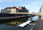
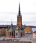
Hebbes Bro februari 2007

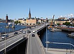
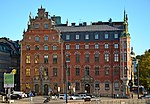
Hebbes Bro (Swedish: "Bridge of Hebbe") is a pedestrian bridge in Gamla stan, the old town of Stockholm, Sweden, connecting the two islands Riddarholmen and Stadsholmen. The bridge was given the name in 1924 after the building next to it owned by Simon Hebbe (1726–1803), manager at the East India Company, shipowner, and head of division of the national board of trade. In 1856-1866 the building in question was incorporated into the Old Parliament Building, which until 1905 was the location for the Riksdag.

Excerpt from the Wikipedia article Hebbes Bro (License: CC BY-SA 3.0, Authors, Images).

Hebbes Bro
Hebbes bro, Stockholm Riddarholmen (Södermalms stadsdelsområde)

Geographical coordinates (GPS) Address External links Nearby Places
placeShow on map

Wikipedia: Hebbes BroContinue reading on Wikipedia

Geographical coordinates (GPS)

Latitude Longitude
N 59.323944444444 ° E 18.066055555556 °
placeShow on map

Address

Hebbes bro

Hebbes bro
114 27 Stockholm, Riddarholmen (Södermalms stadsdelsområde)
Sweden
mapOpen on Google Maps

linkWikiData (Q5695367)
linkOpenStreetMap (34004375)

Hebbes Bro februari 2007
Share experience

Nearby Places

Centralbron
Centralbron

Centralbron (Swedish: [sɛnˈtrɑ̂ːlˌbruːn], "The Central Bridge") is a major bridge in central Stockholm, Sweden, connecting the northern district Norrmalm to the southern Södermalm. It is 1,200 metres long and consists of two viaducts passing over Söderström ("Southern Stream") and Riddarfjärden close to Norrström ("Northern Stream") with an interjacent elevated section traversing Riddarholmskanalen and the adjacent eastern waterfront of Riddarholmen. Centralbron has a capacity for 130,000 cars per day. It is paralleled by the bridges (Södra and Norra järnvägsbron) and the tunnel of a two-track railway used by the commuter and freight trains. Centralbron does partly go on top of the Metro which opened on this stretch 1957 and planned together with the bridge. Over the years, Centralbron together with a suggested additional railway track have been much criticized and debated because of their unwieldy and rumbling presence in a delicate historical setting. Lately, the construction of a tunnel to replace them has been suggested. The cost of such a tunnel, several billion kronor, has put this on hold without any time set. A new metro tunnel has also been suggested because the metro goes below and parallel to Centralbron, making it a total of seven rail tracks and six road lanes crossing the water south of Gamla Stan on bridges. A new railway tunnel costing 15 billion kronor (Citybanan) was finished in 2017 but the existing railway was kept. The older railway is currently being upgraded during eight weeks each summer until 2020.Nearby bridges include Riddarholmsbron, Vasabron, Strömsborgsbron, and Hebbes Bro.

Riddarholmen Church
Riddarholmen Church

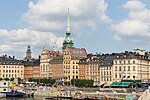
Riddarholmen Church (Swedish: Riddarholmskyrkan) is the church of the former medieval Greyfriars Monastery in Stockholm, Sweden. The church serves as the final resting place of most Swedish monarchs.Riddarholmen Church is located on the island of Riddarholmen, close to the Royal Palace in Stockholm, Sweden. The congregation was dissolved in 1807 and today the church is used only for burial and commemorative purposes. Swedish monarchs from Gustavus Adolphus (d. 1632 AD) to Gustaf V (d. 1950) are entombed here (with only one exception: Queen Christina who is buried within St. Peter's Basilica in Rome), as well as the earlier monarchs Magnus III (d. 1290) and Charles VIII (d. 1470). It has been discontinued as a royal burial site in favor of the Royal Cemetery and today is run by departments of the Swedish Government and Royal Court.It is one of the oldest buildings in Stockholm, parts of it dating to the late-13th century, when it was built as a greyfriars monastery. After the Protestant Reformation, the monastery was closed and the building became a Lutheran church. A spire designed by Flemish architect Willem Boy (1520–1592) was added during the reign of John III, but it was destroyed by a lightning strike on July 28, 1835, after which it was replaced with the present cast-iron spire. Coats of arms of knights of the Royal Order of the Seraphim are on the walls of the church. When a knight of the Order dies, his coat of arms is hung in the church and when the funeral takes place the church's bells are rung without pause from 12:00 to 13:00.

Gamla stan metro station

Gamla stan is a station on the Green and Red lines of the Stockholm metro. It is located on the western side of the Gamla stan (Old town) district of central Stockholm, and is at ground level, although partly under the Centralbron bridge that carries road and mainline rail across the waterways that define the centre of the city. The same waterways are responsible for the ground level location of the station, unusual for a city centre metro station, as the lines cross between the islands of Stadsholmen and Södermalm by a bridge immediately south of the station.The station has two island platforms between four parallel through tracks, with the western platform for trains to the north and the eastern one for trains to the south. Red line trains use the inner pair of tracks and Green line the outer tracks. The platforms are accessed from a ticket hall located under the tracks and platforms. The ticket hall can be reached from Mälartorget, Munkbroleden or Munkbrohamnen.The station site was previously occupied by the Köttorgshallen and Munkbrohallen markets, which were demolished to make way for the metro. The station was opened on 24 November 1957 as part of the Green line connection between Slussen and Hötorget which connected the previously disconnected southern and western sections of that line. On 5 April 1964, the first stretch of the Red line, between T-Centralen and Fruängen, was opened.As part of Art in the Stockholm metro project, in 1998 the station received medieval weaving patterns, weather sun motifs and cement mosaic-patterned floors by Göran Dahl, as well as fencing with weaving patterns between the tracks by Britta Carlström.

Fru Gunillas Gränd
Fru Gunillas Gränd

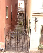
Fru Gunillas Gränd (Swedish: Alley of Mrs. Gunilla) is a historical alley in Gamla stan, the old town in central Stockholm, Sweden, once connecting Skeppsbron to Österlånggatan between Johannesgränd and Packhusgränd. In the old town, minor passages between properties, especially those located just outside the old city wall, were often shut off by adjacent proprietors to be used as back-yards and filled with heaps of rubbish, and were frequently the subject for lengthy legal proceedings between proprietors and the city during the 17th century. While some of these alleys, such as Mårten Trotzigs Gränd, today the narrowest alley in the old town, was reopened in 1945, Fru Gunillas Gränd remains closed. During the 15th, 16th, and 17th centuries, it was open in both ends, thereafter closed off towards Skeppsbron, and, judging from its absence on a map dated 1733, then sealed off in both ends.The alley was known as Doktor Belows gränd during the end of the 17th century, probably in reference to a major proprietor in the block constantly disputing the use of the alley with his neighbours. It is most likely the alley named Herr Henning Pinnows gränd ("Alley of Mr. Henning Pinnow") and Herr Måns Erikssons gränd ("Alley of Mr. Måns Eriksson") in the 15th century, the former known to have sold a house to the latter in 1472. In 1513, the alley was then named after Gunilla Johansdotter Bese (1473–1553), wife of Erik Turesson Bielke (-1511) and mother to the grandfather of Queen Gunilla Bielke (1568–1597), and in 1674 the alley was even referred to as Sancta Gunillas gränd ("Alley of St Gunilla").