place

Jefferson County, West Virginia

1801 establishments in VirginiaCounties of AppalachiaFormer counties of VirginiaJefferson County, West VirginiaPages with non-numeric formatnum arguments
Populated places established in 1801Use mdy dates from December 2021Washington metropolitan areaWest Virginia countiesWest Virginia counties on the Potomac River
2016 09 27 12 32 38 The Jefferson County Court House at the intersection of West Virginia State Route 115 (George Street) and West Virginia State Route 51 (Washington Street) in Charles Town, Jefferson County, West Virginia

Jefferson County is located in the Shenandoah Valley in the Eastern Panhandle of West Virginia. It is the easternmost county of the U.S. state of West Virginia. As of the 2020 census, the population was 57,701. Its county seat is Charles Town. The county was founded in 1801, and today is part of the Washington metropolitan area.

Excerpt from the Wikipedia article Jefferson County, West Virginia (License: CC BY-SA 3.0, Authors, Images).

Jefferson County, West Virginia
16th Avenue,

Geographical coordinates (GPS) Address Nearby Places
placeShow on map

Wikipedia: Jefferson County, West VirginiaContinue reading on Wikipedia

Geographical coordinates (GPS)

Latitude Longitude
N 39.31 ° E -77.86 °
placeShow on map

Address

16th Avenue

16th Avenue
25438
West Virginia, United States
mapOpen on Google Maps

2016 09 27 12 32 38 The Jefferson County Court House at the intersection of West Virginia State Route 115 (George Street) and West Virginia State Route 51 (Washington Street) in Charles Town, Jefferson County, West Virginia
Share experience

Nearby Places

Charles Town Mining, Manufacturing, and Improvement Company Building

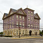
The Charles Town Mining, Manufacturing, and Improvement Company Building in Ranson, Jefferson County, West Virginia is a Romanesque Revival building that now serves as Ranson's City Hall. It was built for the Charles Town Mining, Manufacturing and Improvement Company (CMM&I) in 1891 as its headquarters. The CMM&I sought to develop industry in the area that in 1910 became the City of Ranson. The company was formed in 1890 by Roger Preston Chew, Frank Beck, Forrest W. Brown, T.C. Green, W.F. Lippitt, A.W. McDonald and B. C. Washington, with Chew as president. Using 850 acres (3.4 km2) of land purchased from the Ranson family, a planned community was laid out by D.G. Howell, a Washington, D.C. landscape architect and civil engineer. In 1891 the 3½ story headquarters was built, designed by J.C. Holmes. By 1893 the CMM&I was facing hard times, possibly as a result of the Panic of 1893, and the headquarters was sold to the Board of Education of Charles Town, and served as the white Charles Town High School from 1893 to 1912. The school was sometimes known as both the "Keyhole School,” due to its distinctive entrance, and as the Wright Denny School. In 1917 the Board of Education sold the school to former mayor Gerard D. Moore, and upon his death the property went to H.C. Getzendanner for $4500. Part of the building was used as a confectionery and the north half became the Ranson Post Office. In 1936 the City of Ranson bought the building for $3000 as its City Hall, although apartments occupied the upper floors until the 1970s.