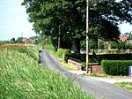
Swinefleet

Swinefleet is a village and civil parish in the East Riding of Yorkshire, England. It is situated approximately 2 miles (3.2 km) south-east of the town of Goole on the A161 road from Goole to Crowle. It lies on the south bank of the River Ouse. According to the 2011 UK census, Swinefleet parish had a population of 787, an increase on the 2001 UK census figure of 748. The main centre of population is at the extreme north of the parish, close to the River Ouse. The southern part of the parish is part of Swinefleet and Reedness Moors, and is characterised by drainage ditches and a few farm buildings.A local bus company, known as Sweyne Coaches is based in Swinefleet. They used to run public services between Scunthorpe and Goole but still do school services for Goole High School and the Holy Family Catholic High School in Carlton, and private hire services. The public services have been taken over by East Yorkshire Motor Service in 2015. It is also home to the Swinefleet Peat Works, which is now derelict.
Excerpt from the Wikipedia article Swinefleet (License: CC BY-SA 3.0, Authors, Images).Swinefleet
Quayfield Square,
Geographical coordinates (GPS) Address Nearby Places Show on map
Geographical coordinates (GPS)
| Latitude | Longitude |
|---|---|
| N 53.689598 ° | E -0.833992 ° |
Address
Quayfield Square
Quayfield Square
DN14 8DG , Swinefleet
England, United Kingdom
Open on Google Maps


