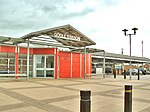
Goole Fields
Civil parishes in the East Riding of YorkshireUse British English from March 2011

Goole Fields is a civil parish in the East Riding of Yorkshire, England. It is situated approximately 3 miles (4.8 km) south-west of Goole town centre and lies at both sides but mainly south of the A161 road (Swinefleet Road), covering an area of 1,980.59 hectares (4,894.1 acres). It is bordered to the east by the Swinefleet Warping Drain, to the south by the Blackwater Dike, and to the west by the railway line from Goole to Doncaster.
Excerpt from the Wikipedia article Goole Fields (License: CC BY-SA 3.0, Authors, Images).Goole Fields
Geographical coordinates (GPS) Address External links Nearby Places Show on map
Geographical coordinates (GPS)
| Latitude | Longitude |
|---|---|
| N 53.6752 ° | E -0.8683 ° |
Address
Goole Fields
England, United Kingdom
Open on Google Maps


