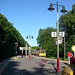
Pollokshields

Pollokshields (Scottish Gaelic: Buthan Phollaig, Scots: Powkshiels) is an area in the Southside of Glasgow, Scotland. Its modern boundaries are largely man-made, being formed by the M77 motorway to the west and northwest with the open land of Pollok Country Park and the Dumbreck neighbourhood beyond, by the Inverclyde Line railway and other branches which separate its territory from the largely industrial areas of Kinning Park, Kingston and Port Eglinton, and by the Glasgow South Western Line running from the east to south, bordering Govanhill, Strathbungo, Crossmyloof and Shawlands residential areas. There is also a suburban railway running through the area. Pollokshields is a conservation area which was developed in Victorian times according to a plan promoted by the original landowners, the Stirling-Maxwells of Pollok, whose association with the area goes as far back as 1270. The core of the area was constructed in two distinct and contrasting styles, with the western part consisting mainly of large villas with gardens along sweeping, undulating tree-lined boulevards, whereas the eastern part (once a separate burgh) is formed by three-storey sandstone tenements typical of many parts of the city from the era, arranged in a tight grid of streets on relatively flat ground.
Excerpt from the Wikipedia article Pollokshields (License: CC BY-SA 3.0, Authors, Images).Pollokshields
Aytoun Road, Glasgow Pollokshields
Geographical coordinates (GPS) Address Nearby Places Show on map
Geographical coordinates (GPS)
| Latitude | Longitude |
|---|---|
| N 55.8423 ° | E -4.285 ° |
Address
Aytoun Road
G41 5HP Glasgow, Pollokshields
Scotland, United Kingdom
Open on Google Maps


