Rancho San Pedro

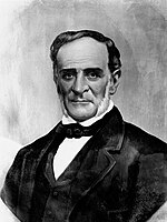
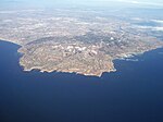
Rancho San Pedro was one of the first California land grants and the first to win a patent from the United States. The Spanish Crown granted the 75,000 acres (300 km2) of land to soldier Juan José Domínguez in 1784, with his descendants validating their legal claim with the Mexican government at 48,000 acres (190 km2) in 1828, and later maintaining their legal claim through a United States patent validating 43,119 acres (174.50 km2) in 1858. The original Spanish land grant included what today consists of the Pacific coast cities of Los Angeles harbor, San Pedro, the Palos Verdes peninsula, Torrance, Redondo Beach, Hermosa Beach, and Manhattan Beach, and east to the Los Angeles River, including the cities of Lomita, Gardena, Harbor City, Wilmington, Carson, Compton, and western portions of Long Beach and Paramount.
Excerpt from the Wikipedia article Rancho San Pedro (License: CC BY-SA 3.0, Authors, Images).Rancho San Pedro
Carriage Drive,
Geographical coordinates (GPS) Address Nearby Places Show on map
Geographical coordinates (GPS)
| Latitude | Longitude |
|---|---|
| N 33.77 ° | E -118.32 ° |
Address
Carriage Drive 715
90274 , Rolling Hills Estates
California, United States
Open on Google Maps


