place

Saint Helen's Island
1874 establishments in CanadaExpo 67Heritage sites in Quebec (Cultural Heritage Act)Hochelaga ArchipelagoIslands of the Saint Lawrence River
Landforms of MontrealParc Jean-DrapeauRiver islands of QuebecUse Canadian English from January 2023
Parc Jean Drapeau
Parc Jean Drapeau

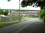
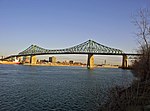
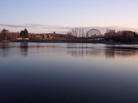
Saint Helen's Island (French: Île Sainte-Hélène) is an island in the Saint Lawrence River, in the territory of the city of Montreal, Quebec, Canada. It forms part of the Hochelaga Archipelago. It is situated immediately offshore from Old Montreal on the southeastern side of the Island of Montreal in southwestern Quebec, and is part of the central borough of Ville-Marie. The Le Moyne Channel separates it from Notre Dame Island. Saint Helen's Island and Notre Dame Island together make up Jean-Drapeau Park (formerly Parc des Îles). It was named in 1611 by Samuel de Champlain in honour of his wife, Hélène de Champlain, née Boullé. The island belonged to the Le Moyne family of Longueuil from 1665 until 1818, when it was purchased by the British government. A fort (Saint Helen Island Fort), powderhouse and blockhouse were built on the island as defences for the city, in consequence of the War of 1812.

Excerpt from the Wikipedia article Saint Helen's Island (License: CC BY-SA 3.0, Authors, Images).

Saint Helen's Island
Chemin du Tour-de-l'Isle, Montreal Ville-Marie

Geographical coordinates (GPS) Address Nearby Places
placeShow on map

Wikipedia: Saint Helen's IslandContinue reading on Wikipedia

Geographical coordinates (GPS)

Latitude Longitude
N 45.517777777778 ° E -73.533888888889 °
placeShow on map

Address

Chemin du Tour-de-l'Isle
H3C 6A3 Montreal, Ville-Marie
Quebec, Canada
mapOpen on Google Maps

Parc Jean Drapeau
Parc Jean Drapeau
Share experience

Nearby Places

Expo 67 pavilions
Expo 67 pavilions

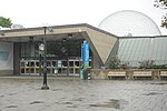
The Expo 67 International and Universal Exposition featured 90 pavilions representing Man and His World, on a theme derived from Terre des Hommes, written by the famous French pilot Antoine de Saint-Exupéry. The exposition displayed many nations, corporations, industries, technologies, social themes, religions, and designs, including the US pavilion, a geodesic dome designed by Buckminster Fuller. Expo 67 also featured Habitat 67, an urban modular housing complex designed by architect Moshe Safdie, whose units were purchased by private Montrealers after the fair was concluded and is still occupied today. The most popular display of the exposition was the soaring Soviet Union pavilion, which attracted about 13 million visitors. Rounding out the top five pavilions (by attendance) were: Canada (11 million visitors), the United States (9 million), France (8.5 million), and Czechoslovakia (8 million).The participating countries were: Africa: Algeria, Cameroon, Chad, Congo, Ivory Coast, Ethiopia, Gabon, Ghana, Kenya, Madagascar, Morocco, Mauritius, Niger, Rwanda, Senegal, Tanzania, Togo, Tunisia, Uganda, and Upper Volta; Asia: Burma, Ceylon, China (Taiwan), Korea, India, Iran, Israel, Japan, Thailand and the United Arab Republic; Australia; Europe: Austria, Belgium, Czechoslovakia, Denmark, Finland, France, Federal Republic of Germany, Greece, Iceland, Italy, Monaco, the Netherlands, Norway, Sweden, Switzerland, United Kingdom, the USSR, and Yugoslavia; South America & Caribbean: Barbados, Cuba, Grenada, Guyana, Haiti, Jamaica, Trinidad and Tobago, and Venezuela; North America: Canada, Mexico, and the United States.Absent countries included the People's Republic of China, Spain, South Africa (banned from BIE-sanctioned events due to its apartheid policy), and many countries of South America.