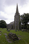
Worsley

Worsley () is a village in the City of Salford in Greater Manchester, England, which in 2014 had a population of 10,090. It lies along Worsley Brook, 5.75 miles (9.25 km) west of Manchester. Within the boundaries of the historic county of Lancashire, there is evidence of Roman and Anglo-Saxon activity, including two Roman roads. The completion in 1761 of the Bridgewater Canal allowed Worsley to expand from a small village of cottage industries to an important town based upon cotton manufacture, iron-working, brick-making and extensive coal mining. Later expansion came after the First and Second World Wars, when large urban estates were built. Worsley Delph is a scheduled monument and a significant part of the town's historic centre is now a conservation area.
Excerpt from the Wikipedia article Worsley (License: CC BY-SA 3.0, Authors, Images).Worsley
Kempnough Hall Road, Salford
Geographical coordinates (GPS) Address Nearby Places Show on map
Geographical coordinates (GPS)
| Latitude | Longitude |
|---|---|
| N 53.5093 ° | E -2.3845 ° |
Address
Kempnough Hall Road
Kempnough Hall Road
M28 2QP Salford
England, United Kingdom
Open on Google Maps


