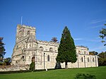
Manshead
Bedfordshire geography stubsHundreds of Bedfordshire

Manshead was a hundred of Bedfordshire in England. It covered an area in the south-west of the county stretching from Salford to Studham and from Leighton Buzzard to Houghton Regis and Dunstable.The hundred was named after a site in Eversholt parish. The name appears as "Maunesheved", with Thomas Camill as the bailiff. in 1349. The area west of the Watling Street is recorded in the Domesday Book as the half-hundred of Stanbridge, and there is also a mention of a hundred called Odecroft which may have covered the area south of the Ouzel Brook. By the early 14th century, these areas had effectively been incorporated into Manshead hundred.
Excerpt from the Wikipedia article Manshead (License: CC BY-SA 3.0, Authors, Images).Manshead
Humphrys Road,
Geographical coordinates (GPS) Address Nearby Places Show on map
Geographical coordinates (GPS)
| Latitude | Longitude |
|---|---|
| N 51.897 ° | E -0.508 ° |
Address
Humphrys Road
Humphrys Road
LU5 4TA , Woodside Estate
England, United Kingdom
Open on Google Maps


