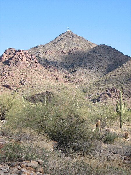
McDowell Mountains

The McDowell Mountain Range (Yavapai: Wi:kajasa) is located about twenty miles north-east of downtown Phoenix, Arizona, and may be seen from most places throughout the city. The range is composed of miocene deposits left nearly five million years ago. The McDowells share borders with the cities of Fountain Hills, Scottsdale, and Maricopa County. The city of Scottsdale has made its share of the McDowells a preserve, and has set up a wide trail network in partnership with the McDowell Sonoran Conservancy. The McDowell Sonoran Conservancy was established in 1991. The highest peak in the McDowells is East End, at 4,069 feet (1,240 m). This mountain range also serves as a sacred marker to the Yavapai people. The boundaries of the range are generally defined by Saddleback Mountain in the South and Granite Mountain as the Northern boundary. The McDowells also comprise popular landmarks such as Pinnacle Peak and Tom's Thumb. Although technically a stand-alone, Mt. McDowell (referred to as Red Mountain by Phoenix residents), not to be confused with McDowell Peak, is sometimes listed on maps as a part of the McDowell Mountains.
Excerpt from the Wikipedia article McDowell Mountains (License: CC BY-SA 3.0, Authors, Images).McDowell Mountains
Bell Pass Trail, Scottsdale
Geographical coordinates (GPS) Address Nearby Places Show on map
Geographical coordinates (GPS)
| Latitude | Longitude |
|---|---|
| N 33.65 ° | E -111.81666666667 ° |
Address
Bell Pass Trail
Bell Pass Trail
85060 Scottsdale
Arizona, United States
Open on Google Maps


