Severn River Bridge
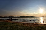
The Severn River Bridge, officially known as the Pearl Harbor Memorial Bridge, is a bridge that crosses the Severn River northwest of the city limits of Annapolis, Maryland. The bridge serves as part of the John Hanson Highway, which is signed as U.S. Route 50 (US 50) and U.S. Route 301 (US 301). Maryland Route 2 (MD 2) also traverses the bridge, but no MD 2 signs exist along the section of highway the route traverses. MD 2 separates from US 50/301 east of the bridge and becomes Governor Ritchie Highway, and to the west of the bridge it leaves the highway along Solomons Island Road. The bridge serves as the main connection between Annapolis and points east, including the Eastern Shore via the Chesapeake Bay Bridge; however, unlike the rest of US 50/301 in the area, the bridge lacks shoulders and is often a point of traffic congestion and numerous accidents.
Excerpt from the Wikipedia article Severn River Bridge (License: CC BY-SA 3.0, Authors).Severn River Bridge
Blue Star Memorial Highway,
Geographical coordinates (GPS) Address External links Nearby Places Show on map
Geographical coordinates (GPS)
| Latitude | Longitude |
|---|---|
| N 39.006388888889 ° | E -76.503541666667 ° |
Address
Pearl Harbor Memorial Bridge
Blue Star Memorial Highway
22409
Maryland, United States
Open on Google Maps


