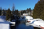
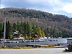
Saint-Adolphe-d'Howard

Saint-Adolphe-d'Howard is a municipality in the Laurentian Mountains, in the Province of Quebec, Canada, north-west of Montreal. Saint-Adolphe-d'Howard is home to Mont-Avalanche ski resort.
Excerpt from the Wikipedia article Saint-Adolphe-d'Howard (License: CC BY-SA 3.0, Authors, Images).Saint-Adolphe-d'Howard
Chemin Lapointe,
Geographical coordinates (GPS) Address Nearby Places Show on map
Geographical coordinates (GPS)
| Latitude | Longitude |
|---|---|
| N 45.97 ° | E -74.33 ° |
Address
Chemin Lapointe 1342
J0T 2B0
Quebec, Canada
Open on Google Maps
Nearby Places
Sainte Agathe Academy
Sainte Agathe Academy (SAA; French: Académie Sainte Agathe) is a public anglophone primary and secondary school in Sainte-Agathe-des-Monts, Quebec. It is operated by the Sir Wilfrid Laurier School Board. Persons from the following communities are zoned to this school for the elementary level: Sainte-Agathe-des-Monts, Doncaster, Ivry-sur-le-Lac, L'Ascension, La Conception, La Macaza, La Minerve, Labelle, Lac-Supérieur, Lantier, Mont-Blanc, Mont-Tremblant, Rivière-Rouge, Saint-Donat, Sainte-Agathe-des-Monts, Sainte-Lucie-des-Laurentides, Val-David, Val-des-Lacs, and Val-Morin, as well as the northern half of Saint-Adolphe-d'Howard. All areas zoned for the elementary level are also zoned for the secondary level. In addition, students from other areas are assigned to secondary classes here; they include: Amherst, Arundel, Barkmere, Brébeuf, and Huberdeau."About Us."


