place

New South Wales Golf Club

1926 establishments in AustraliaAustralian sports venue stubsGolf club and course stubsGolf clubs and courses designed by Alister MacKenzieGolf clubs and courses in New South Wales
La Perouse, New South WalesNew South Wales building and structure stubsSports clubs and teams established in 1926Sports clubs and teams in SydneySports venues completed in 1926Sports venues in SydneyUse Australian English from December 2015
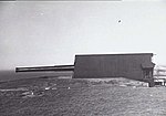
A1capebanks0072
A1capebanks0072

The New South Wales Golf Club is a links-style golf course designed by Alister MacKenzie in December 1926. It consists of 18 holes, two of which are beside the Tasman Sea and Botany Bay. The course is situated in La Perouse, New South Wales, a suburb of Sydney, and regularly rates in the top 50 golf courses in the world.MacKenzie, on designing the course, stated: "At Sydney, I made an entirely new course for the New South Wales Golf Club at a place called La Perouse. This presents, I think, more spectacular views than any place I know with the possible exception of the new Cypress Point golf course in California."A unique feature of the course design is that it has four par-five holes and four par-three holes and each of these is oriented north, south, east and west. It has hosted numerous professional tournaments, including the 2009 Australian Open; won by Adam Scott.

Excerpt from the Wikipedia article New South Wales Golf Club (License: CC BY-SA 3.0, Authors, Images).

New South Wales Golf Club
Cape Banks Road, Sydney Little Bay

Geographical coordinates (GPS) Address Phone number Website External links Nearby Places
placeShow on map

Wikipedia: New South Wales Golf ClubContinue reading on Wikipedia

Geographical coordinates (GPS)

Latitude Longitude
N -33.994722222222 ° E 151.24388888889 °
placeShow on map

Address

NSW Golf Club

Cape Banks Road
2036 Sydney, Little Bay
New South Wales, Australia
mapOpen on Google Maps

Phone number

call+61296614455

Website
nswgolfclub.com.au

linkVisit website

linkWikiData (Q194787)
linkOpenStreetMap (3045927)

A1capebanks0072
A1capebanks0072
Share experience

Nearby Places

Botany Bay
Botany Bay

Botany Bay (Dharawal: Kamay) is an open oceanic embayment, located in Sydney, New South Wales, Australia, 13 km (8 mi) south of the Sydney central business district. Its source is the confluence of the Georges River at Taren Point and San Souci as well as the Cooks River at Kyeemagh, which flows 10 km (6 mi) to the east before meeting its mouth at the Tasman Sea, midpoint between the suburbs of La Perouse and Kurnell. The northern headland of the entrance to the bay from the Tasman Sea is Cape Banks and, on the southern side, the outer headland is Cape Solander and the inner headland is Sutherland Point. The total catchment area of the bay is approximately 55 km2 (21 sq mi). Despite its relative shallowness, the bay now serves as greater metropolitan Sydney's main cargo seaport, located at Port Botany, with facilities managed by Sydney Ports Corporation. Two runways of Sydney Airport extend into the bay, as do some port facilities. Kamay Botany Bay National Park is located on the northern and southern headlands of the bay. The area surrounding the bay is generally managed by Transport for NSW. The land adjacent to Botany Bay was settled for many thousands of years by the Tharawal and Eora peoples and their associated clans. On 29 April 1770, Botany Bay was the site of James Cook's first landing of HMS Endeavour on the land mass of Australia, after his extensive navigation of New Zealand. Later the British planned Botany Bay as the site for a penal colony. Out of these plans came the first European habitation of Australia at Sydney Cove. Although the penal settlement was almost immediately shifted to Sydney Cove, for some time in Britain transportation to "Botany Bay" was a metonym for transportation to any of the Australian penal settlements.