Sataf
Arab villages depopulated during the 1948 Arab–Israeli WarArchaeological sites in IsraelDistrict of JerusalemPages with non-numeric formatnum argumentsSprings of Israel

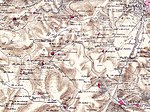
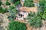
Sataf (Arabic: صطاف, Hebrew: סטף) was a Palestinian village in the Jerusalem Subdistrict depopulated during the 1948 Arab–Israeli War. It was located 10 km west of Jerusalem, with Sorek Valley (Arabic: Wadi as-Sarar) bordering to the east. Two springs, Ein Sataf and Ein Bikura flow from the site into the riverbed below. A monastery located across the valley from Sataf, i.e. south of Wadi as-Sarar, known by local Arabs as Ein el-Habis (the "Spring of the Hermitage"), is officially called Monastery of Saint John in the Wilderness. Today it is a tourist site showcasing ancient agricultural techniques used in the Jerusalem Mountains.
Excerpt from the Wikipedia article Sataf (License: CC BY-SA 3.0, Authors, Images).Sataf
Cliff Trail, Mate Yehuda Regional Council
Geographical coordinates (GPS) Address Nearby Places Show on map
Geographical coordinates (GPS)
| Latitude | Longitude |
|---|---|
| N 31.769166666667 ° | E 35.127222222222 ° |
Address
סטף - חניה תיכונה
Cliff Trail
9574320 Mate Yehuda Regional Council
Jerusalem District, Israel
Open on Google Maps


