place

Charterhouse Street

London road stubsOdonyms referring to a buildingSmithfield, LondonStreets in the City of LondonStreets in the London Borough of Islington
Use British English from June 2015
Smithfield cold store large

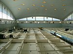
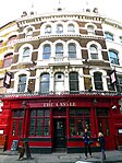
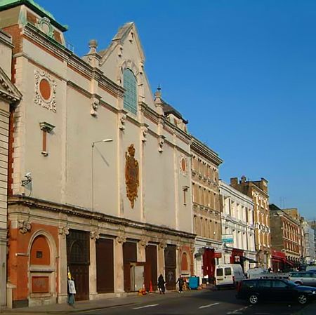
Charterhouse Street is a street on the north side of Smithfield in the City of London. The road forms part of the City’s boundary with the neighbouring London Boroughs of Islington and Camden. It connects Charterhouse Square and Holborn Circus, crossing Farringdon Road and running along a number of historical sites, including Smithfield Market. Charterhouse Street is perhaps most famous for its gastropubs, such as the Fox and Anchor, that attract local City workers and is a popular venue for revellers, with Fabric nightclub located at No. 77A. The street was the home of several refrigerated warehouses serving Smithfield Meat Market including the Central Cold Store, the Metropolitan Cold Stores at 77A and Port of London Authority Cold Store. Charterhouse Street is also the home of a 31 MWe combined heat and power plant operated by Citigen (E.ON) and located within and beneath the former PLA cold store.The site on the corner of Farringdon Road was occupied by the 1960s Caxton House which was demolished in 2009 as part of the Farringdon station extension. The nearest London Underground stations are Barbican near the east end of Charterhouse Street and Farringdon further west. Farringdon station also provides a connection to Crossrail and Thameslink rail services.

Excerpt from the Wikipedia article Charterhouse Street (License: CC BY-SA 3.0, Authors, Images).

Charterhouse Street
Charterhouse Street, City of London

Geographical coordinates (GPS) Address Nearby Places
placeShow on map

Wikipedia: Charterhouse StreetContinue reading on Wikipedia

Geographical coordinates (GPS)

Latitude Longitude
N 51.5191 ° E -0.10361666666667 °
placeShow on map

Address

Charterhouse Street 55
EC1A 9LY City of London
England, United Kingdom
mapOpen on Google Maps

Smithfield cold store large
Share experience

Nearby Places

Snow Hill tunnel (London)

Snow Hill tunnel is a railway tunnel on the northern edge of the City of London which carries the up and down Snow Hill lines between City Thameslink and Farringdon stations. The tunnel runs beneath the Smithfield meat market and was constructed, using the cut-and-cover method, immediately prior to the building of the market. The tunnel opened on 1 January 1866. Snow Hill tunnel was constructed by the London, Chatham and Dover Railway (LC&DR) to connect its line from Herne Hill to the recently opened Metropolitan Railway's Widened Lines, south of Farringdon station. To the north-west, the Widened Lines in turn connected to the tracks of the Great Northern Railway at King's Cross, and the Midland Railway at St Pancras, via tunnels running beneath the two main line termini. Snow Hill tunnel thus provided the crucial link in the only north–south railway route through central London, enabling a number of main line railway companies to run cross-London passenger and goods services. In 1871, an additional, eastwards tunnel was opened, which had connection to the Metropolitan Railway's tracks, enabling trains from the south to also serve Aldersgate (now Barbican) and Moorgate Street (now Moorgate) stations. The eastward curve also connected to an extensive Great Western Railway goods station beneath Smithfield market (now a car park). This Smithfield Curve (which had a very tight radius and could not be used by bogie stock) closed in 1916. The goods station, like those of the GNR, Midland Railway and the Metropolitan Railway, all located nearby, is no longer in use. A station, also named Snow Hill, was opened in the tunnel in 1874, providing an interchange with the LC&DR's adjacent terminus at Holborn Viaduct station. Snow Hill station closed in 1916, although the tunnel remained in use for goods traffic until the end of the 1960s. The tracks were lifted in 1971 and the tunnel was abandoned for fifteen years until works began in 1986 to bring the north–south route back into operation as part of the Thameslink route. New tracks were laid in 1988 and services reopened in 1990. Initially, it was expected that a new station would be built at the site, but this was transferred to what is now City Thameslink (originally called St Paul's Thameslink). The southern end of the tunnel was originally adjacent to Holborn Viaduct station, with trains running on viaduct between there and Blackfriars. As part of the Thameslink works, the viaduct was demolished and replaced with a new section of cut and cover tunnel running most of the way to Blackfriars, incorporating City Thameslink station. To provide clearance for the new tunnel below, road levels at the western end of Ludgate Hill and in the adjacent junction of Ludgate Circus were raised several feet. In 2008, a report by the Planning Inspectorate into a proposed development of the General Market Building, stated that the tunnel structure, known as "the lids", urgently required either repair or replacement. The tunnel lids are supported by girders which have deteriorated due to steam exhaust gases and, more recently, wet conditions resulting from failed waterproofing of the decks above. However, Network Rail maintained that the condition of the structure was not dissimilar to many others of the same age on the network, and is comfortable that it is safe as it currently stands.