place

Mystic Lakes (Boston)

AC with 0 elementsArlington, MassachusettsLakes of MassachusettsLakes of Middlesex County, MassachusettsMedford, Massachusetts
Meromictic lakesMystic RiverWinchester, Massachusetts
Aerial photograph of Upper Mystic Lake

The Mystic Lakes, consisting of Upper Mystic Lake and Lower Mystic Lake, are closely linked bodies of water in the northwestern suburbs of Boston, Massachusetts. The lakes lie at an elevation of 1 meter above sea level, within the towns of Winchester, Arlington, and Medford, Massachusetts. Upper Mystic Lake is fed by the Aberjona River, and drains south, over the Mystic Dam, into Lower Mystic Lake, which in turn empties into the Mystic River and then Boston Harbor.

Excerpt from the Wikipedia article Mystic Lakes (Boston) (License: CC BY-SA 3.0, Authors, Images).

Mystic Lakes (Boston)
Mystic Valley Parkway,

Geographical coordinates (GPS) Address Nearby Places
placeShow on map

Wikipedia: Mystic Lakes (Boston)Continue reading on Wikipedia

Geographical coordinates (GPS)

Latitude Longitude
N 42.431666666667 ° E -71.148333333333 °
placeShow on map

Address

Medford Boat Club Parking Lot

Mystic Valley Parkway
02174
Massachusetts, United States
mapOpen on Google Maps

Aerial photograph of Upper Mystic Lake
Share experience

Nearby Places

Mystic Dam
Mystic Dam

The Mystic Dam (and its gatehouse) are a historic dam and gatehouse between Lower and Upper Mystic Lakes in the suburbs north of Boston, Massachusetts. The dam was built in 1864–65 by the Charlestown Water Commission (Charlestown then being separate from Boston) as part of a water supply system. It was located at a narrow point between the Lower and Upper Mystic Lakes, with its west end in Arlington and its east end in Medford. The water system it was a part of eventually merged into the Metropolitan District Commission (MDC), predecessor to the Massachusetts Water Resources Authority (MWRA) and the Massachusetts Department of Conservation and Recreation (DCR).As built, the dam was over 1,500 feet (460 m) long and 16 feet (4.9 m) high, with most of that length (about 1,000 feet (300 m)) consisting of earthen embankments lined with riprap and puddle clay. Near its center is a spillway area consisting of a series of square columns constructed of granite blocks and a masonry apron. These columns are grooved on their inner faces to facilitate the installation of stop logs. A wooden walkway with a plank railing ran across the top of the dam. A wooden fish ladder was built, but removed at a later date. A gatehouse on the Medford side was used to connect the upper lake to a brick-lined aqueduct that delivered the water to Charlestown. The lake area impounded by the dam is 186 acres (75 ha).The dam and gatehouse were each listed on the National Register of Historic Places in 1990. By the early 2000s, the dam was known to not be in very good condition, with failing spillway masonry, erosion, and other damage to the dam's stonework. A major storm in 2006 flooded portions of the surrounding area, and highlighted the potential inability of the dam to handle a significant high-water event, leading to catastrophic flooding of downstream areas. Between 2010 and 2012 major work was undertaken to improve the dam's condition. A new spillway was constructed to the east of the old spillway, which received a new spillway apron. Work was done on the embankments and the shores near the upper areas of the dam, and a new fish ladder and bridge were built. The historic gatehouse was also rehabilitated, and modern controls were added, enabling improved control over the water levels behind the dam.

Edmund Dwight House
Edmund Dwight House

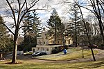
The Edmund Dwight House is a historic house at 5 Cambridge Street in Winchester, Massachusetts, straddling the town line with Arlington. It was built in 1858 in an Italianate style. It was one of the first and grandest country houses built in Winchester at a time when Boston businessmen were seeking to build such houses. Edmund Dwight, the wealthy businessman who was its first owner, was married to a great-granddaughter of Thomas Jefferson. The house's design is believed to be based loosely on that of Jefferson's Monticello. The house is sited for an expansive view of the Upper Mystic Lake. This residence was also home to Claude Shannon, the father of Information theory, and his wife Betty Shannon. While living there, they installed a chair lift that took the rider from the home down to the lake.The house is a 2+1⁄2-story wood-frame structure, originally finished in clapboard siding. It is basically rectangular, with a rounded central bay on the eastern facade, facing the lake. A single-story porch wraps around three sides of the building. Significant alterations were made to the house in the 1890s, including the stuccoing of the exterior, and the addition of a two-story ell to the northeast corner. These changes were made under the auspices of local architect Robert Coit. A second, single-story, addition was made to the northwest corner in 1985. The original 12-acre (4.9 ha) property purchased by the Dwights was subdivided c. 1940, leaving the house on just 2 acres (0.81 ha). The house's stable was then converted to a residence, and stands on an adjacent lot in Arlington.The house was added to the National Register of Historic Places in 1989.

Shepherd Brooks Estate

The Shepherd Brooks Estate is an historic property at 275 Grove Street in Medford, Massachusetts. The 82-acre (33 ha) property is owned by the city of Medford, and managed by a trust established to preserve the property. Its principal feature is the manor house constructed in 1880 by Shepherd Brooks, a member of a prominent Medford family, and is the only major 19th-century estate to survive relatively undeveloped in the city. The grounds are open to the public daily from dawn to dusk, and tours of the house are available during the summer. The estate was developed by Brooks, a member of the locally prominent Brooks family that dominated West Medford for many years, as a summer estate and gentleman's farm. The manor house was designed by Peabody & Stearns, and is a large red brick house, with Queen Anne styling. It has a complex roofline with many gables, and there is a port cochere. A carriage barn stands near the main house. The estate originally included a second summer house called Point of Rocks, which had been built by Peter Chardon Brooks III in 1859, but this was demolished by the city in the 20th century. The city acquired the 82-acre remnant of the Brooks estate after the death of Shepherd Brooks' wife Clara in 1939. After the Second World War the city used the estate to provide housing for veterans, and in the 1960s and 70s it was used as a nursing home. From the 1970s through the late 1980s the Manor building was used as a group home for mentally-challenged adults. The proposal in 1992 to erect a cellphone tower near the Shepherd Brooks Manor created a firestorm from local residents. The Brooks Estate Preservation Association, a citizen-led group, was formed to change the City of Medford's lack of leadership. A four-year effort to preserve the Brooks Estate in perpetuity was successfully completed with the passage of the Conservation and Preservation Restriction in 1998, which permanently protected the Manor, Carriage house and 50-acres of land from development and cemetery expansion. Local conservationists then worked to permanently protect the property.The property was added to the National Register of Historic Places in 1975.