place

Wessenden Valley

Use British English from December 2016Valleys of England
WessendenValley
WessendenValley

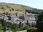
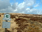
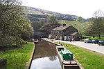
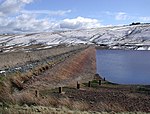
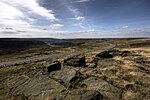
The Wessenden Valley is a moorland valley in the Dark Peak, immediately south of Marsden in West Yorkshire, England. The name Wessenden derives from Old English and means the 'valley with rock suitable for whetstones'. The valley was formed by retreating glaciers at the end of the last ice age and continues to be cut by the Wessenden Brook a tributary of the River Colne with a catchment of 6.28 square miles (16.27 km2).The valley is in the Marsden Moor Estate and occupied by four reservoirs, namely Wessenden Head, Wessenden, Blakeley and Butterley, the largest. The Kirklees Way and Pennine Way long-distance footpaths follow the valley. The upper part of the valley near Wessenden Head is managed by the National Trust as part of the 5,000-acre (2,000 ha) Marsden Moor Estate.Butterley Reservoir's spillway, the only one of its kind in England, was a Grade II Listed structure until Yorkshire Water renovated it using concrete after winning a case on appeal.

Excerpt from the Wikipedia article Wessenden Valley (License: CC BY-SA 3.0, Authors, Images).

Wessenden Valley
Butterley Reservoir Circular, Kirklees

Geographical coordinates (GPS) Address Nearby Places
placeShow on map

Wikipedia: Wessenden ValleyContinue reading on Wikipedia

Geographical coordinates (GPS)

Latitude Longitude
N 53.586 ° E -1.929 °
placeShow on map

Address

Butterley Reservoir Circular

Butterley Reservoir Circular
HD7 6HH Kirklees
England, United Kingdom
mapOpen on Google Maps

WessendenValley
WessendenValley
Share experience

Nearby Places

Marsden Moor Estate
Marsden Moor Estate

The Marsden Moor Estate is a large expanse of moorland in the South Pennines, between the conurbations of West Yorkshire and Greater Manchester in the north of England. It is named after the adjacent town of Marsden, and is owned and administered by the National Trust to whom it was conveyed in 1955 by the Radcliffe family in lieu of death duties. The estate covers 2,429 ha (5,685 acres) of unenclosed common moorland and almost surrounds Marsden. Part of it is in the most northern section of the Peak District National Park. The landscape is made up of moorland, valleys, peaks and crags and has long been modified by man. Marsden is at the eastern gateway to the important ancient Standedge crossing of the moors and evidence of transport related archaeological remains dating from pre-Roman times have been discovered close to the great engineering structures of the canal and railway ages. The moors have been a water catchment area since the Victorian era when several reservoirs were built, along with their associated catchwaters in the Wessenden Valley. The Pennine Way and the Peak District Boundary Walk run across the moors (following the same route between Wessenden and Redbrook Reservoirs.The landscape supports large numbers of moorland birds such as the golden plover, red grouse, Eurasian curlew and twite. The estate, a designated Site of Special Scientific Interest, forms part of a Special Protection Area and is a candidate Special Area of Conservation.The estate is managed from a base in the old goods yard, adjacent to Marsden railway station, and the old goods shed has been converted into a public exhibition, entitled Welcome to Marsden, which gives an overview of the estate and its history.The moor has been affected by fires. Dozens of firefighters were required to put out a blaze in 2011. A fire in February 2019, during an unseasonal spell of warm weather, was described by West Yorkshire Fire and Rescue Service as one of the biggest moorland fires it had ever had to deal with.

Standedge Tunnels
Standedge Tunnels

The Standedge Tunnels () are four parallel tunnels through the Pennine hills at the Standedge crossing between Marsden in Kirklees, West Yorkshire and Diggle in Oldham, Greater Manchester in northern England. Three are railway tunnels (containing the Huddersfield line) and the other is a canal tunnel. Before boundary changes in 1974, both ends of the tunnels were in the West Riding of Yorkshire. The canal tunnel on the Huddersfield Narrow Canal was authorised by an Act of Parliament on 4 April 1794. Construction of a 5,451-yard (4,984 m) tunnel began months later. Within two years, cost-saving measures pushed back its completion date and progress was slowed by water levels much greater than had been expected. It proved difficult to secure skilled help, some tenders went unanswered and Benjamin Outram withdrew from the venture. In 1807, Thomas Telford drew up a new plan for its completion. In 1811, the tunnel opened. It is the longest and oldest of the four Standedge tunnels and is the longest, highest, and deepest canal tunnel in the United Kingdom. Having been closed to all traffic in 1943, the canal tunnel was re-opened in May 2001. The first, single-track railway tunnel, built for the London and North Western Railway (LNWR) on its line between Huddersfield and Manchester, was completed in 1848. It proved to have insufficient capacity and a second, parallel, single-track tunnel was opened in 1871. The LNWR opened a third, double-track tunnel in 1894. Only the double-track tunnel is currently used for rail traffic; the other two are intact but disused. All four tunnels are linked by cross-tunnels or adits at strategic intervals which allowed the railway tunnels to be built without construction shafts and allowed waste material to be removed by boat. The Standedge Tunnel Visitor Centre, at the Marsden end, is a base for boat trips into the tunnel and has an exhibition depicting the different crossings.

Greenfield Valley
Greenfield Valley

Greenfield Valley is a river valley through Saddleworth Moor in England's Peak District National Park. Historically this area of the South Pennines was part of Yorkshire but since 1974 it has been within the eastern edge of the county of Greater Manchester.The valley and the surrounding Saddleworth Moor are designated as 'Open Access' land for the public, following the Countryside and Rights of Way Act 2000. Much of Saddleworth Moor is a 9,000 year-old peat landscape of blanket bog. The upper Greenfield Valley is part of the Dark Peak SSSI (Site of Special Scientific Interest). The millstone grit moorland is typically covered with grasses, mosses, heather and bilberry and is habitat for mountain hares and moorland birds such as red grouse, lapwing, skylark, curlew, golden plover and meadow pipit. The RSPB operates Dove Stone Nature Reserve in the valley, which includes old quarry cliffs that are home to peregrine falcons.The Trinnacle is a dramatic large stack of three gritstone pillars at Raven Stones Brow. Since glaciers and ice sheets carved the cliff edge during the last Ice Age, weathering and frost-shattering of the rocks over thousands of years have formed the three-pronged Trinnacle outcrop. There are nearly 200 graded rock climbing routes on Ravenstones Crag.The valley's main stream Greenfield Brook is fed by Holme Clough and Birchen Clough. Greenfield Brook flows into Greenfield Reservoir and then on into Yeoman Hey Reservoir and Dovestone Reservoir. It then flows into Chew Brook which is a tributary of the River Tame, which feeds the River Mersey.The Ashton under Lyne, Stalybridge and Dukinfield Waterworks Joint Committee's reservoir scheme began in the Greenfield Valley in 1870. Yeoman Hey Reservoir was completed in 1880 (capacity of 780 million litres and 20m deep). Greenfield Reservoir was built from 1897 to 1902. It is the smallest of the reservoirs (capacity of 464 million litres and 20m deep). Dovestone Reservoir is the largest of the three reservoirs in the valley. It has a capacity of 4887 million litres and is up to 31m deep. The dam is 38m high and 550m long. It was built in 1967 and the Dovestone Sailing Club was established the same year. The reservoirs are operated by United Utilities and supply water to the surrounding area including Oldham. Spruce and pine plantations are found in the lower valley and broad-leaved trees have been introduced to provide a more diverse habitat. Industrialist John Platt built Ashway Gap House in 1850 on the south side of the valley. It was used as a shooting lodge until his brother James (MP for Oldham) was killed in a grouse shooting accident on the moors in 1857. Ashway Cross was erected on the moorland as a memorial to James. The vacant mansion and its estate were bought in 1897 by the waterworks board, which allowed it to be used as a Red Cross hospital for wounded soldiers during World War I. In World War II the house was used to billet Italian prisoners of war. After the house fell into decline it was demolished in 1981.There are two World War II pillboxes (gun emplacements) on the A635 road opposite Yeoman Hey Reservoir. The pillboxes were built into a rock outcrop in c.1940 as part of defences against a possible invasion. The pair are connected by an underground passage. They are protected Grade II listed buildings.Downstream from the reservoirs is Greenfield village in the Chew Valley.