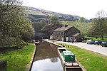
Saddleworth Moor
Moorlands of EnglandMountains and hills of Greater ManchesterMountains and hills of the Peak DistrictPeak DistrictProtected areas of Greater Manchester ... and 5 more
Protected areas of West YorkshireSaddleworthTourist attractions in KirkleesTourist attractions in the Metropolitan Borough of OldhamUse British English from June 2018

Saddleworth Moor is a moorland in North West England. Reaching more than 1,312 feet (400 m) above sea level, it is in the Dark Peak area of the Peak District National Park. It is crossed by the A635 road and the Pennine Way passes to its eastern side.
Excerpt from the Wikipedia article Saddleworth Moor (License: CC BY-SA 3.0, Authors, Images).Saddleworth Moor
Holmfirth Road,
Geographical coordinates (GPS) Address Nearby Places Show on map
Geographical coordinates (GPS)
| Latitude | Longitude |
|---|---|
| N 53.543333333333 ° | E -1.9558333333333 ° |
Address
Holmfirth Road
OL3 7NW , Saddleworth
England, United Kingdom
Open on Google Maps


