Ralston Peak
El Dorado County, California geography stubsMountains of El Dorado County, CaliforniaMountains of Northern CaliforniaMountains of the Desolation WildernessMountains of the Sierra Nevada (United States) ... and 1 more
North American 2000 m summits

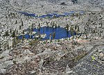
Ralston Peak is a mountain in the Sierra Nevada mountain range to the west of Lake Tahoe within the Desolation Wilderness in El Dorado County, California. Ralston Peak is a very popular mountain to summit for the views of the wilderness area as it lies very near U.S. Route 50. The closest trailhead to the summit can be found in Camp Sacramento a few miles west of Echo Summit. Ralston Peak can also be accessed from the Pacific Crest Trail between Echo Lake and Lake Aloha. Starting at the nearest trailhead (Echo Lake), this route is significantly longer than the trail from Camp Sacramento. But the altitude gain on this route is much less, and the trail is much less steep.
Excerpt from the Wikipedia article Ralston Peak (License: CC BY-SA 3.0, Authors, Images).Ralston Peak
Ralston Peak Trail,
Geographical coordinates (GPS) Address Nearby Places Show on map
Geographical coordinates (GPS)
| Latitude | Longitude |
|---|---|
| N 38.83291811 ° | E -120.10173338 ° |
Address
Ralston Peak Trail
Ralston Peak Trail
96155
California, United States
Open on Google Maps


