Washwood Heath
Areas of Birmingham, West MidlandsEngvarB from February 2018Former wards of Birmingham, West MidlandsUnited Kingdom in World War IUnited Kingdom in World War II

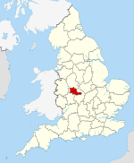
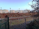
Washwood Heath is a ward in Birmingham, within the formal district of Hodge Hill, roughly two miles north-east of Birmingham city centre, England. Washwood Heath covers the areas of Birmingham that lie between Nechells, Bordesley Green, Stechford and Hodge Hill.
Excerpt from the Wikipedia article Washwood Heath (License: CC BY-SA 3.0, Authors, Images).Washwood Heath
Coronation Road, Birmingham
Geographical coordinates (GPS) Address Nearby Places Show on map
Geographical coordinates (GPS)
| Latitude | Longitude |
|---|---|
| N 52.4969 ° | E -1.8419 ° |
Address
Coronation Road
Coronation Road
B8 2UU Birmingham
England, United Kingdom
Open on Google Maps


