Barnaby Woods

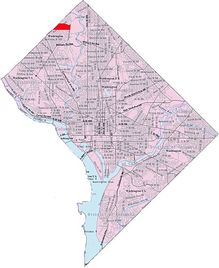
Barnaby Woods is a neighborhood in the Northwest quadrant of Washington, D.C., wedged between Rock Creek Park and Montgomery County, Maryland. It is bounded on the north by Aberfoyle Place, on the west by Western Avenue, on the south by Tennyson Street, and on the east by Oregon Avenue. Barnaby Woods is entirely residential, with no commercial zoning whatsoever, and the housing consists primarily of 1930s colonial homes on large parcels of land although on Unicorn Lane NW there are only townhouses. Barnaby Woods is in the 2nd Police district and is within Police Service Area (PSA) 201. Barnaby Woods residents are within the sending districts of Lafayette Elementary School, Deal Middle School and Jackson-Reed High School.
Excerpt from the Wikipedia article Barnaby Woods (License: CC BY-SA 3.0, Authors, Images).Barnaby Woods
31st Place Northwest, Washington
Geographical coordinates (GPS) Address Nearby Places Show on map
Geographical coordinates (GPS)
| Latitude | Longitude |
|---|---|
| N 38.9744 ° | E -77.0597 ° |
Address
31st Place Northwest 6356
20015 Washington
District of Columbia, United States
Open on Google Maps


