Damyns Hall Aerodrome
Airports in the London regionPages with non-numeric formatnum argumentsTransport in the London Borough of HaveringUse British English from May 2013

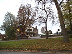
Damyns Hall Aerodrome (ICAO: EGML) is an operational general aviation training and experience aerodrome 2 nautical miles (3.7 km; 2.3 mi) south of Upminster in the London Borough of Havering, England and slightly closer to Aveley to its south. It has around 100 acres of grassland and is owned and operated by Damyns Hall Aerodrome Limited.
Excerpt from the Wikipedia article Damyns Hall Aerodrome (License: CC BY-SA 3.0, Authors, Images).Damyns Hall Aerodrome
Aveley Road, London Corbets Tey (London Borough of Havering)
Geographical coordinates (GPS) Address Website External links Nearby Places Show on map
Geographical coordinates (GPS)
| Latitude | Longitude |
|---|---|
| N 51.528611111111 ° | E 0.24555555555556 ° |
Address
Damyns Hall Aerodrome
Aveley Road
RM14 2TQ London, Corbets Tey (London Borough of Havering)
England, United Kingdom
Open on Google Maps


