place

Sanjay Gandhi National Park

1969 establishments in MaharashtraBorivaliEngvarB from September 2013IUCN Category IIMalabar Coast moist forests
Mumbai Suburban districtNational parks in MaharashtraParks in MumbaiProtected areas established in 1969
Entrance of Sanjay Gandhi National Park

Sanjay Gandhi National Park is a 87 km2 (34 sq mi) protected area in Mumbai, Maharashtra State in India. It was established in 1969 with headquarters at Borivali.The 2400-year-old Kanheri caves sculpted by monks out of the rocky cliffs, lie within the park. The rich flora and fauna of Sanjay Gandhi National Park attract more than 2 million visitors every year.

Excerpt from the Wikipedia article Sanjay Gandhi National Park (License: CC BY-SA 3.0, Authors, Images).

Sanjay Gandhi National Park
Mumbai Metropolitan Region

Geographical coordinates (GPS) Address Nearby Places
placeShow on map

Wikipedia: Sanjay Gandhi National ParkContinue reading on Wikipedia

Geographical coordinates (GPS)

Latitude Longitude
N 19.25 ° E 72.916666666667 °
placeShow on map

Address

Yeoor


400610 Mumbai Metropolitan Region, Yeoor
Maharashtra, India
mapOpen on Google Maps

Entrance of Sanjay Gandhi National Park
Share experience

Nearby Places

Kanheri Caves
Kanheri Caves

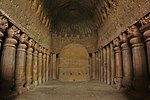
The Kanheri Caves (Kānherī-guhā [kaːnʱeɾiː ɡuɦaː]) are a group of caves and rock-cut monuments cut into a massive basalt outcrop in the forests of the Sanjay Gandhi National Park, on the former island of Salsette in the western outskirts of Mumbai, India. They contain Buddhist sculptures and relief carvings, paintings and inscriptions, dating from the 1st century CE to the 10th century CE. Kanheri comes from the Sanskrit Krishnagiri, which means black mountain.The site is on a hillside, and is accessible via rock-cut steps. The cave complex comprises one hundred and nine caves. The oldest are relatively plain and unadorned, in contrast to later caves on the site, and the highly embellished Elephanta Caves of Mumbai. Each cave has a stone plinth that functioned as a bed. A congregation hall with huge stone pillars contains a stupa (a Buddhist shrine). Rock-cut channels above the caves fed rainwater into cisterns, which provided the complex with water. Once the caves were converted to permanent monasteries, their walls were carved with intricate reliefs of Buddha and the Bodhisattvas. Kanheri caves were built in the 1st century and had become an important Buddhist settlement on the Konkan coast by the 3rd century CE. Most of the caves were Buddhist viharas, meant for living, studying, and meditating. The larger caves, which functioned as chaityas, or halls for congregational worship, are lined with intricately carved Buddhist sculptures, reliefs, pillars and rock-cut stupas. Avalokiteshwara is the most distinctive figure. The large number of viharas demonstrates there was a well organized establishment of Buddhist monks. This establishment was also connected with many trade centers, such as the ports of Sopara, Kalyan, Nasik, Paithan and Ujjain. Kanheri was a University center by the time the area was under the rule of the Maurayan and Kushan empires. In the late 10th century, the Buddhist teacher Atisha (980–1054) came to the Krishnagiri Vihara to study Buddhist meditation under Rahulagupta.

Ghodbunder Fort
Ghodbunder Fort

Ghodbunder Fort is a fort located in Ghodbunder Village, Thane, Maharashtra, India, on the hill just south of the Ulhas River. It was built by the Portuguese, occupied by the Maratha Empire, and became the East India Company's district headquarters. The place was called Ghodbunder because it was where the Portuguese used to trade for ghode (horses) with the Arabs. Hence the name Ghodbunder: ghode (horses) & bunder (port). In 1530 the Portuguese came to Thane, and they began fortifying the hill area about 1550, but completion of the fort in its current form was in 1730. The Portuguese name for the fort was Cacabe de Tanna. It was under Portuguese rule until 1737. The Portuguese built a church in the fort that still stands, and is now used as a hotel. Two angels engraved on the inside wall of the church still remains. The old church can be seen clearly in the background of the courtyard photo. There are many old maps and texts which mention continual attempts by the Marathas to capture this fort. The Portuguese were able to defend Ghodbunder Fort from these attacks successfully for many years, including the attack in 1672 by the forces of Shivaji. However, the Marathas under Chimnaji Appa successfully besieged the fort and took it over from the Portuguese in 1737. Following its capture, Sambhaji ordered the strengthening of the fortifications, initiating the construction of the tower.In 1818, the British occupied the fort and made it the headquarters of the district administration for the East Indian Company, with a district collector stationed in Thane.Although the fort currently lies in ruins, the government of India has started its renovation. The fort itself is under the control of the Archaeological Survey of India (ASI).