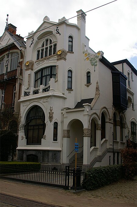
Zurenborg

Zurenborg is an area in south-east Antwerp largely developed between 1894 and 1906 that features a high concentration of townhouses in Art Nouveau and other fin-de-siècle styles.Together with Zuid, the urban quarter around the Royal Museum of Fine Arts, Zurenborg is unique in Antwerp in that it is among the few areas in the city developed according to an urban plan in the late 19th century. The new neighbourhood reflected Antwerp's growing wealth, linked to growing port and trade activities, well. The northern - largest - area of Zurenborg, centered around Dageraadplaats, was mainly developed for the middle class, while the southern area, around Cogels Osylei, was mainly targeted to the well to do. The most eastern corner, which currently includes a bus yard of the public transport company and a power transfer station, was more devoted to industries and logistics, including a gas factory and a terminus station of a regional tram system. Engetrim, a development and construction company, had the lead in developing Zurenborg. Before, Zurenborg was an agricultural area dominated by an estate belonging to the Osy family.
Excerpt from the Wikipedia article Zurenborg (License: CC BY-SA 3.0, Authors, Images).Zurenborg
Tramplein, Antwerp
Geographical coordinates (GPS) Address Nearby Places Show on map
Geographical coordinates (GPS)
| Latitude | Longitude |
|---|---|
| N 51.205555555556 ° | E 4.4325 ° |
Address
Draakplaats
Tramplein
2600 Antwerp
Antwerp, Belgium
Open on Google Maps


