1996 Docklands bombing
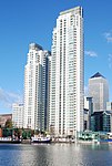
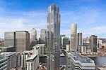
The London Docklands bombing (also known as the South Quay bombing or erroneously referred to as the Canary Wharf bombing) occurred on 9 February 1996, when the Provisional Irish Republican Army (IRA) detonated a powerful truck bomb in South Quay (which is outside Canary Wharf). The blast killed two people and devastated a wide area, causing an estimated £150 million worth of damage. The IRA had sent warnings 90 minutes beforehand, but the area was not fully evacuated. As well as the two people who were killed, more than 100 were injured, some permanently. The attack marked an end to the IRA's seventeen-month ceasefire, and came just over an hour after its declaration to Irish broadcaster RTÉ. The IRA agreed to the ceasefire in August 1994 on the understanding that Sinn Féin would be allowed to take part in peace negotiations, but resumed its campaign with the Docklands bombing when the British government demanded a full IRA disarmament as a precondition for talks. After the bombing, the British government dropped its demand. A few months later, the IRA detonated another, more powerful truck bomb in Manchester. IRA member James McArdle was convicted of the bombing in 1998. He had been a member of an IRA sniper team in South Armagh. He was released two years later, under the terms of the Good Friday Agreement.
Excerpt from the Wikipedia article 1996 Docklands bombing (License: CC BY-SA 3.0, Authors).1996 Docklands bombing
Marsh Wall, London Isle of Dogs
Geographical coordinates (GPS) Address Nearby Places Show on map
Geographical coordinates (GPS)
| Latitude | Longitude |
|---|---|
| N 51.500555555556 ° | E -0.018055555555556 ° |
Address
Johns & Co
Marsh Wall 70
E14 9SL London, Isle of Dogs
England, United Kingdom
Open on Google Maps
