Kartal
6th-century establishments in the Byzantine EmpireDistricts of Istanbul ProvinceFishing communities in TurkeyKartalMetropolitan district municipalities in Turkey ... and 2 more
Populated places established in the 6th centuryPopulated places in Istanbul Province

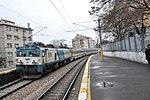
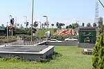
Kartal is a municipality and district of Istanbul Province, Turkey. Its area is 38 km2, and its population is 483,418 (2022). It is located on the Asian side of the city, on the coast of the Marmara Sea between Maltepe and Pendik. Despite being far from the city centre, Kartal is heavily populated (total population nearly 500,000). The district's neighbours are Maltepe to the west, Sultanbeyli and Sancaktepe to the north and Pendik to the east. Inland from the coast, the land rises sharply up to the hills Yakacık and Aydos, the latter of which is the highest point in Istanbul.
Excerpt from the Wikipedia article Kartal (License: CC BY-SA 3.0, Authors, Images).Kartal
Turgut Özal Bulvarı,
Geographical coordinates (GPS) Address Nearby Places Show on map
Geographical coordinates (GPS)
| Latitude | Longitude |
|---|---|
| N 40.887222222222 ° | E 29.19 ° |
Address
Turgut Özal Bulvarı
Turgut Özal Bulvarı
34860 , Kordonboyu Mahallesi
Turkey
Open on Google Maps


