Col des Montets

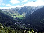
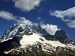
Col des Montets (elevation 1,461 m or 4,793 ft) is a mountain pass in the French Alps in the Haute-Savoie department of France. It is on the road between Chamonix, the Swiss Col de la Forclaz and Martigny in the canton of Valais, Switzerland. The pass is generally open in winter, but it can be closed in extreme weather and frequently requires snow chains and/or winter tires. Conditions can be checked with Chamonix tourist office. The railway tunnel of the Saint-Gervais–Vallorcine railway has been modified to also carry road traffic on a convoy basis between trains when the pass is closed. Elizabeth Robins Pennell bicycled through the pass in the 1890s.The pass appeared in the Tour de France five times from 1959 to 1977: Charly Gaul was the first rider to cross the pass in 1959.
Excerpt from the Wikipedia article Col des Montets (License: CC BY-SA 3.0, Authors, Images).Col des Montets
Sentier Botanique, Bonneville
Geographical coordinates (GPS) Address Nearby Places Show on map
Geographical coordinates (GPS)
| Latitude | Longitude |
|---|---|
| N 46.003611111111 ° | E 6.9233333333333 ° |
Address
Sentier Botanique
Sentier Botanique
74400 Bonneville
Auvergne-Rhône-Alpes, France
Open on Google Maps


