Noke, Oxfordshire
Cherwell DistrictCivil parishes in OxfordshireOtmoorOxfordshire geography stubsUse British English from August 2015 ... and 1 more
Villages in Oxfordshire

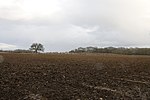
Noke is a small village and civil parish in Oxfordshire about 5 miles (8 km) northeast of Oxford. It is on the southeast edge of Otmoor and is one of the "Seven Towns of Otmoor". The toponym is derived from Old English and means "at the oak trees". The parish still has two woodlands: Prattle Wood about 500 yards (460 m) southwest of the village, and Noke Wood about 1 mile (1.6 km) to the southeast.
Excerpt from the Wikipedia article Noke, Oxfordshire (License: CC BY-SA 3.0, Authors, Images).Noke, Oxfordshire
Prattle Lane, Cherwell District
Geographical coordinates (GPS) Address Nearby Places Show on map
Geographical coordinates (GPS)
| Latitude | Longitude |
|---|---|
| N 51.814 ° | E -1.213 ° |
Address
Prattle Lane
OX3 9TQ Cherwell District
England, United Kingdom
Open on Google Maps


