place

Hunt Club

Neighbourhoods in OttawaUse Canadian English from January 2023
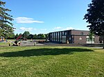
Hunt Club Riverside Park Community Centre, Ottawa

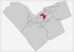
Hunt Club is a community in River Ward, in the south end of Ottawa, Ontario, Canada. The area is named after the Ottawa Hunt and Golf Club, which was first developed in 1876. Hunt Club Road and many local businesses were also named after the golf course.Hunt Club is located just north of the Ottawa Macdonald–Cartier International Airport and to the east of the Rideau River. The Hunt Club Community Organization defines the boundaries as the Rideau River to the west, the Airport Parkway to the east, the CN Albion line and Via Rail Beachburg Subdivision to the north, and Hunt Club Road to the south. The population of the area is 12,264 as of the 2016 Canadian census.16% of the area is publicly accessible green space. It has three times as much green space as the Ottawa average, including the Sawmill Creek wetlands and Rideau River shoreline. Hunt Club has seven city parks: Cahill, McCarthy, Owl, Paul Landry, Riverwood, Uplands, and Uplands Riverside. Hunt Club has a mixed demographic in terms of age groups, ethnocultural backgrounds, socio-economic levels, and family set-ups. The area also has the second-largest Asian Canadian population in Ottawa. Housing in the area includes single dwellings, semi-detached and townhouse units, apartment buildings, retirement homes, and housing projects. Hunt Club was originally settled by Europeans in the early nineteenth century, and it was originally part of Gloucester Township. In 1950, the still largely rural area was annexed into the city of Ottawa. Development of the area began in the 1970s, and many houses and buildings in the area are from this period. It was designed as a bedroom community with little commercial space.

Excerpt from the Wikipedia article Hunt Club (License: CC BY-SA 3.0, Authors, Images).

Hunt Club
Paul Anka Drive, Ottawa

Geographical coordinates (GPS) Address Website Nearby Places
placeShow on map

Wikipedia: Hunt ClubContinue reading on Wikipedia

Geographical coordinates (GPS)

Latitude Longitude
N 45.35 ° E -75.675 °
placeShow on map

Address

Royalton Place

Paul Anka Drive 3360
K1V 9S2 Ottawa (River)
Ontario, Canada
mapOpen on Google Maps

Website
metcap.com

linkVisit website

Hunt Club Riverside Park Community Centre, Ottawa
Share experience

Nearby Places

Riverside Park, Ottawa

Riverside Park is a neighbourhood in the south end of Ottawa, Canada. It is bounded on the north by Brookfield Road, on the east by the Airport Parkway, on the south by the CN rail tracks and on the west by the Rideau River. The neighbourhood includes one of Ottawa's most well known beaches at Mooney's Bay and the Terry Fox Athletic Facility, along with both Vincent Massey Park, Hog's Back Park. Confederation Heights sits at the northern tip of the neighbourhood. It also includes the Ottawa Hunt and Golf Club, which has hosted professional and amateur golf tournaments. The area is served by Brookfield High School and the General Vanier, Bayview Public Schools, Georges Étienne Cartier as well as the Holy Cross Catholic School. In addition to Mooney's Bay, the area is served by four other parks; Paget Park, Marble Park, Flannery Park and Pauline Vanier Park, adjacent to General Vanier Public School. In August 2007, Bayview Public School was closed at its site on Riverside drive. Its French immersion program moved to the R. Byrns Curry Public School building (renamed Bayview Public School). R. Byrns Curry students were reassigned to General Vanier Public School (J-K to grade 3) and Fielding Drive Public School (grades 4 to 8).The neighbourhood is bifurcated by OCRR Railway. The area west of it is known as Riverside Park West and the area east of it is called Riverside Park East. The area to the south of Walkley Road is known as Riverside Park South. According to the Canada 2011 Census, the population of the neighbourhood north of Walkley (Census Tract 5050003.00) was 4564 and south of Walkley (Census Tract 5050002.01) was 2893 for a total of 7457.

South Keys Shopping Centre

South Keys Shopping Centre, officially SmartCentres Ottawa South, is a shopping centre in the South Keys neighbourhood of Ottawa, Ontario, Canada. It is owned and operated by SmartCentres. The power centre is built on 56 acres of land with 486,127 square feet of store space. Walmart serves as the mall's anchor. Eight separate buildings house the centre's 20 stores and services which include supermarkets, restaurants, banks, and a movie theatre. South Keys Shopping Centre was first opened in 1996. The property is bound by Johnston Road to the north, Bank Street to the east, Dazé Street to the south, and the Transitway to the west. SmartCentres notes that there are 50,638 households comprising 71,374 people within a 5km radius of the shopping centre. The average household income within this radius is CA$113,539.OC Transpo's Transitway runs north-south along the back of the shopping centre with Greenboro station serving the mall's north end and South Keys station serving the south end. Greenboro station also features a park and ride and access to the Trillium Line. Stage 2 of the O-Train expansion project will see South Keys station connected with the Trillium Line and the new Airport Link in 2023. The shopping centre has been the location of several minor and major crimes. At around 9:00 a.m. on July 28, 2013, the body of a deceased female was found in the ditch between the Kelsey's parking lot and Bank Street. The following day, she was identified as 28-year-old Melissa Richmond, who had been missing for the previous two weeks. It was Ottawa's seventh homicide of the year. On November 26, 2015, her husband, 53-year-old Howard Richmond, was found guilty of first degree murder. At around 6:30 p.m. on November 23, 2018, a 27-year-old man, Yonis Barkhadle, one of three brothers who were well known to police in the city, was fatally shot in the parking lot at the north end of the mall.Since 2015, the City of Ottawa has been considering redeveloping South Keys Shopping Centre into a mixed-use area.