place

Pfäffikersee

Canton of Zürich geography stubsGlatt basinHigh Rhine basinLakes of SwitzerlandLakes of the canton of Zürich
PfäffikerseePfäffikon, ZürichSeegräbenWetzikon
Pfäffikersee
Pfäffikersee

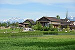
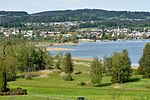
Pfäffikersee (or Lake Pfäffikon) is a lake in the canton of Zürich, Switzerland, near the town of Pfäffikon. It is 2.5 km long and 1.3 km wide at the middle. The lake was created in the last ice age when a moraine blocked off the ability for the lake to empty north towards Winterthur. There is also a hiking trail around the lake that people often bike and walk on, and the area is considered protected lands, among them the Robenhauser Ried and the prehistoric settlement Wetzikon–Robenhausen, discovered and researched by Jakob Messikommer (1828–1917), which became a serial site of the UNESCO World Heritage Site Prehistoric pile dwellings around the Alps. In Roman era, along Pfäffikersee there was a Roman road from the vicus Centum Prata (Kempraten) on Obersee–Lake Zürich via Vitudurum (Oberwinterthur) to Tasgetium (Eschenz) to the Rhine. To secure this important transport route, the Irgenhausen Castrum was built.

Excerpt from the Wikipedia article Pfäffikersee (License: CC BY-SA 3.0, Authors, Images).

Geographical coordinates (GPS)

Latitude Longitude
N 47.352222222222 ° E 8.78 °
placeShow on map

Address

In der Tarn


8330
Zurich, Switzerland
mapOpen on Google Maps

Pfäffikersee
Pfäffikersee
Share experience

Nearby Places

Aatal (Valley)
Aatal (Valley)

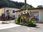
The Aatal (Aa Valley) is a narrow, steep valley of about 40 metres (130 ft) depth surrounded by forests. It is situated between the towns of Wetzikon and Uster in the canton of Zürich, Switzerland. Through the valley flows the river Aabach, which starts at the effluence of the southern end of the Pfäffikersee and then enters Wetzikon where the river makes a U-turn in the middle of the town towards a southwestern direction before it enters the valley. After the valley of about 4 kilometres (2.5 mi) the Abbach enters Uster, where it also used to be called Usterner Aa, runs through Uster in a western direction before it enters the Greifensee about in the middle of the lake's eastern shore, near Niederuster. The hamlet of Aathal in the middle of the valley belongs to the municipality of Seegräben. The Aa Valley is a significant traffic artery. It connects the metropolitan area of Zurich with the municipalities of the Zürich Oberland (Zurich Highlands). In addition to the heavy traffic on the national expressway between Uster and Wetzikon the three S-Bahn railway lines S5, S14, and S15 traverse the valley, each at a half-hourly clock-face schedule so that in average every 5 minutes a train passes through the valley. The S14 stops in Aathal half-hourly. Besides the buildings of different former spinning mills, which are connected by an industrial teaching path, one finds also the Aathal Dinosaur Museum in Aathal. During the 18/19th century the water power was intensely used by the cotton industry. Since 2008, there are attempts to re-use the small hydroelectric power plants for power production. Ten power plants operate again nowadays.