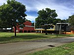
Lockridge, Western Australia
Lockridge is a suburb of Perth, in the Bassendean division of Western Australia, and the City of Swan local government area. Land was first granted in the area to Edward Hamersley in 1837. Its name is derived from that of Lockeridge House, a property built by his son, Samuel Hamersley, in 1874. Part of what is now Lockridge, which became the Pyrton Estate, was bought by the Western Australian government during the Soldier settlement scheme in the 1920s. In 1969, the State Housing Commission purchased 240 acres (97 ha) to begin residential development in the area. An urban renewal project was undertaken in the late 1990s.At the 2016 Australian census the suburb had a population of 3,467.Local amenities include Rosher Park, Kiara College, Lockridge Primary School, and the Alice Daveron Community Centre. The Swan Valley Nyungah Community was in the area.
Excerpt from the Wikipedia article Lockridge, Western Australia (License: CC BY-SA 3.0, Authors).Lockridge, Western Australia
Kerwin Way, City Of Swan
Geographical coordinates (GPS) Address Nearby Places Show on map
Geographical coordinates (GPS)
| Latitude | Longitude |
|---|---|
| N -31.881 ° | E 115.947 ° |
Address
Kerwin Way
Kerwin Way
6054 City Of Swan, Lockridge
Western Australia, Australia
Open on Google Maps


