place

Södermalm

Districts of StockholmIslands of Stockholm
Södermalm
Södermalm

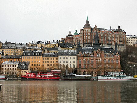
Södermalm, often shortened to just Söder, is a district and island in central Stockholm.

Excerpt from the Wikipedia article Södermalm (License: CC BY-SA 3.0, Authors, Images).

Södermalm
Magnus Ladulåsgatan, Stockholm Södermalm (Södermalms stadsdelsområde)

Geographical coordinates (GPS) Address Phone number Website Nearby Places
placeShow on map

Wikipedia: SödermalmContinue reading on Wikipedia

Geographical coordinates (GPS)

Latitude Longitude
N 59.313055555556 ° E 18.068055555556 °
placeShow on map

Address

Accedo Broadband AB

Magnus Ladulåsgatan
118 27 Stockholm, Södermalm (Södermalms stadsdelsområde)
Sweden
mapOpen on Google Maps

Phone number

call+4687526540

Website
accedo.tv

linkVisit website

Södermalm
Södermalm
Share experience

Nearby Places

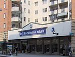
Stockholm South Station

Stockholm South, Stockholms södra, Stockholm S, locally known as Södra Station (Southern Station) is a railway station in Södermalm, Stockholm, Sweden. The Stockholm South railway station was originally opened in the year 1860, and was originally the northern terminus of the Västra Stambanan railway line until the construction of Stockholm Central Station (Stockholm C). The 1860 building was replaced with a new building in 1926. The current station, which includes a large apartment complex above it, began construction in 1986 on the site of the original station, and was opened in 1989. The new station is underground, situated below the site of the old station, and on the railway line it is between Årstaberg and Stockholm C. The trains of the Stockholm commuter rail network stop at this station. About 5 minutes walk on Swedenborgsgatan is the Mariatorget metro station, located 350 metres away. Stockholm South station is also connected to the Södra station–Hammarbyhamnen–Stadsgården freight branch line (sv:Industrispåret Södra station–Hammarbyhamnen–Stadsgården), which was built between 1925 and 1939 and which formerly provided access to the ports and wharves located at Hammarby and Stadsgården and also provided the only mainline connection with the Saltsjöbanan commuter rail system until 2000. A 550-metre underground spur line also branched off from said freight line to the underground complex at Södersjukhuset hospital (constructed 1937–1944).

Medborgarplatsen metro station

Medborgarplatsen, formerly known as Södra Bantorget, is a station on the Green line of the Stockholm metro. It is situated near to the Medborgarplatsen square in the district of Södermalm in central Stockholm, and lies below Götgatan between its junctions with Noe Arksgränden and Folkungagatan. The station has a single island platform, which is accessed by entrances at the junction of Götgatan with Folkungagatan, and in the Björns trädgård. The distance to Slussen is 0.6 km (0.37 mi).Medborgarplatsen is, along with Skanstull, the oldest underground station on the metro, actually predating that system by some years. The station lies in the Södertunneln, a tunnel originally built in 1933 for use by routes 8 and 19 of the Stockholm tramway. Originally known as Södra Bantorget, the station took its current name in 1944. In 1950, it became part of Stockholm's first metro line when the Södertunneln was adapted to become part of the line from Slussen south to Hökarängen. This adaption required an extension of the station platforms to the north to accommodate the metro's trains, and this work was not completed when the line opened on 1 October, with the station not reopening until 1 November. The entance in the Björns trädgård was opened on 29 November 1995.The walls of the station have yellow tiles, partly original from the 1930s. As part of Art in the Stockholm metro project, Gunnar Söderström designed the color scheme of the pillars and walls in 1979. In the southern ticket hall there is a wall decoration and floor mosaic by Mari Pårup from 1997.