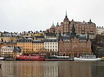
Katarina-Sofia
Government of StockholmStockholm County geography stubs

Katarina-Sofia was a borough (stadsdelsområde) in central Stockholm, named after the two parishes of Katarina and Sofia. Effective January 1, 2007, the borough merged with the borough of Maria-Gamla Stan to form the Södermalm borough. Katarina-Sofia was made up of the eastern half of Södermalm and Hammarby Sjöstad (Södra Hammarbyhamnen). The population as of 2004 was 42,750 on an area of 3.36 km², which gave a density of 12,723.21/km².
Excerpt from the Wikipedia article Katarina-Sofia (License: CC BY-SA 3.0, Authors, Images).Katarina-Sofia
Västgötagatan, Stockholm Södermalm (Södermalms stadsdelsområde)
Geographical coordinates (GPS) Address Nearby Places Show on map
Geographical coordinates (GPS)
| Latitude | Longitude |
|---|---|
| N 59.313611111111 ° | E 18.071111111111 ° |
Address
Västgötagatan 1
118 72 Stockholm, Södermalm (Södermalms stadsdelsområde)
Sweden
Open on Google Maps


