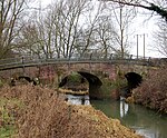
Wappenbury
Villages in WarwickshireWarwickshire geography stubs
Wappenbury is a small village and civil parish in the English county of Warwickshire. Located on the north bank of the River Leam Wappenbury is almost entirely inside the ramparts of an Iron Age hill fort. The population details can be found under Eathorpe. The nearest town is Leamington Spa, some 5 miles to the south west of Wappenbury. During the Second World War its vicar was William Purcell Witcutt. Roman pottery and kilns have been found in the village; which is only 1 mile from the Fosse Way.
Excerpt from the Wikipedia article Wappenbury (License: CC BY-SA 3.0, Authors).Wappenbury
Geographical coordinates (GPS) Address Nearby Places Show on map
Geographical coordinates (GPS)
| Latitude | Longitude |
|---|---|
| N 52.32141 ° | E -1.44684 ° |
Address
CV33 9DW
England, United Kingdom
Open on Google Maps


