Bayswater, Western Australia

Bayswater is a suburb 6 km (4 mi) north-east of the central business district (CBD) of Perth, the capital of Western Australia. It is just north of the Swan River, within the City of Bayswater local government area. It is predominantly a low-density residential suburb consisting of single-family detached homes. However, there are several clusters of commercial buildings, most notably in the suburb's town centre, around the intersection of Whatley Crescent and King William Street and a light industrial area in the suburb's east. Prior to European settlement, the Mooro group of the Whadjuk Noongar people inhabited the area. In 1830, the year after the European settlement of the Swan River Colony, land along the river was divided between the colonists, who moved in soon after. Most either died or left in the months following, leaving the area undeveloped for most of the 19th century. In 1881, the Fremantle–Guildford railway line was built, triggering the founding of the Bayswater Estate, the first development in the area, and in 1897, the Bayswater Road Board was founded, giving Bayswater its own local government. At first, development consisted of nurseries, market gardens and dairies, but as time went on, Bayswater became more and more suburban. Today, Bayswater is fully suburbanised, with the subdividing of older lots being commonplace. Plans for apartments around Bayswater and Meltham railway stations are a contentious issue. Parks and wetlands, including the Baigup Wetlands, the Eric Singleton Bird Sanctuary and Riverside Gardens. There are other parks throughout the suburb, including Bert Wright Park, Halliday Park (which includes a war memorial), Hillcrest Reserve and Houghton Park line Bayswater's Swan River foreshore. Major roads through the suburb include Guildford Road, which connects to the Perth CBD and Tonkin Highway.
Excerpt from the Wikipedia article Bayswater, Western Australia (License: CC BY-SA 3.0, Authors, Images).Bayswater, Western Australia
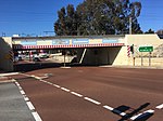
Railway Parade, City Of Bayswater
Geographical coordinates (GPS) Address Nearby Places Show on map
Geographical coordinates (GPS)
| Latitude | Longitude |
|---|---|
| N -31.9175 ° | E 115.91361111111 ° |
Address
Railway Parade
Railway Parade
6053 City Of Bayswater, Bayswater
Western Australia, Australia
Open on Google Maps


